Sunday, February 21, 2010

Mt Brown lookout in snow

Sunday February 21, under a clear sky, I hiked up to the Mt Brown Lookout in Glacier Park.  This trail is the steepest trail in the Park.  I climbed 4,305 ft in 5.8 miles.  The maximum elevation was 7,487 ft.

Needless to say I was tired after the 11.6 mile hike of almost 8 hours (though to be fair I spent over an hour up at the lookout).
 
The hike was all in snow.  Enough people had used snowshoes to get to the lookout that the snow was packed enough that I was able to reach the lookout without using my snowshoes.  I did carry them on my back the entire way as I thought I may need them when I got on high.

Leah was also at the Park on Sunday and took the following two photos.  I believe the lookout is where I marked the photo with the red O.  I started the hike at the lake level.  Mt Brown is the mountain behind the lookout.  That is about 7 miles away.


Here is the view from near the trail head at Lake McDonald.  The lookout is the white bump under the u in 'Lookout'.  In this view you can see the mountain with the lookout is separate from Mt Brown.  The final photo also shows that.


The views were great and I took 200 to 300 photos.  I haven't had time to go through them to weed duplicates and bad photos and to stitch other photos together.  But here are a few photos.

Lots of snow up there!


Leah's first photo was taken at the far end of Lake McDonald near Apgar Village.  That is about 7 miles away.


The mountain just under and to the right of the snow hanging from the lookout roof is Huckleberry Mountain.  I don't remember if I wrote about that hike that I did last Fall.  As you can see there is so much snow that the walkway around the lookout was filled to the railing level.


Photo 1: the rightmost peak of the three peaks is Heaven's Peak.  I forgot the names of the other two peaks.
Photo 2: Mt Brown

Wednesday, February 10, 2010

Blue

Blue skies lead to a blue mood?

Yesterday Joyce and I drove 100 miles and crossed the Continental Divide in search of a blue sky.  We found it once we reached Maria Pass.  The mountain tops held the clouds back and it was solidly clear and blue to the east.

Sun!  Oh, glorious sun!

Around East Glacier everything was coated in a thick frost.


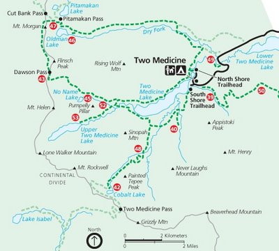
We skied 7 miles to Two Medicine Lake and close to the shadows from the clouds trying to get past the mountains.  The wind brought occasional snow flakes flying floating by.

Late afternoon we watched the looming clouds and anticipated the loss of sunlight as we drove back to and under the massive line of clouds.  Even after we entered the cloud's shadow we could still see the snow covered mountains to our side lit by the sunlight.  Then all traces of sunlight were gone.


Today I have a 'hangover' from my blue sky experience.  It is gloomy and gray here yet again for another day and the forecast has this forever.  I miss seeing the blue sky.

Tonight there was a story on the local weather forecast that said that the Flathead Valley has had five days of blue skies since December 1.  Only five days!  Fortunately I spent a few weeks back in Minnesota and North Dakota since December so I saw more than just five days of sun.  Still... I want more sun.

It didn't help that Leah forwarded me some photos taken by a friend of hers who hiked up to Mt Brown Lookout last weekend.  This hike is on my list of things to do this winter and I haven't made it up there yet.

Tuesday, February 9, 2010

Two Medicine ski

Tuesday, February 9, 2010 Joyce and I skied to Two Medicine Lake.  We liked the idea of visiting the lake in the Winter, but mainly we were looking for blue skies.  The Flathead Valley had only 5 full days of sun since December 1.


Once we reached Marias Pass on the Continental Divide the clouds ended and it was nothing but blue skies ahead.  Around East Glacier everything was white, having been covered by thick frost.


Once we had crossed the Continental Divide there was hardly any snow.  We had hoped to ski but also brought snowshoes and hiking boots for whatever the conditions were.  It can get windy in the Two Medicine Valley and we expected most of the snow to be blown off the road.  To our surprise we could only drive a half mile off of Hwy 49 on the road to Two Medicine.  Any more would be risking it - and Joyce didn't bring a shovel along in her car.  Probably a quarter mile down the road was the furthest any vehicle had traveled.  Judging from the broken pine branches they must have used them for traction in helping them get unstuck.


At the end of the afternoon when we returned to the car we saw fresh tracks.  That vehicle didn't go as far as seen in the above photo before they wised up and turned around.


Our destination is to the left of the leftmost white mountain (Rising Wolf Mountain) in the distance.  We had already skied a half mile to a mile when I took this photo.  Lower Two Medicine Lake is in the foreground.


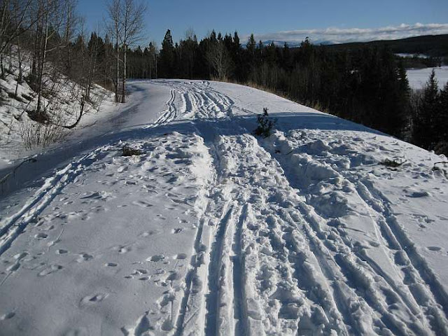
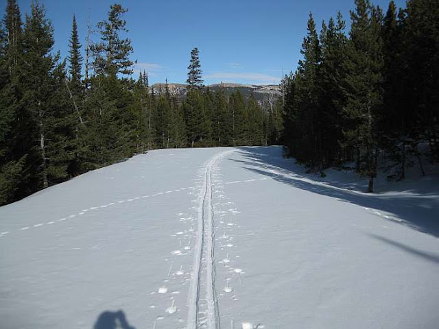
There were plenty of ski tracks in the snow.  And some foot prints.  The snow depth varied from a small amount to deep.  When the snow was deep the footprints sunk deep even though the person tried to walk in various ski tracks.  The further we went the less tracks.  By the time we reached the Glacier Park gate only a few tracks were left.


Shortly after we entered the park the snow disappeared from the road and we had to ski in the ditch.  By now there was only one set of ski tracks.  The bare road last several miles.  The ski tracks turned around short of the return of the road snow.  If they had only gone around one more bend in the road...


We skied the .3 mile to see Running Eagle Falls.  I was able to ski relatively close to the falls.  I even skied/climbed up to the observation platform and back down without falling into the water.  In fact I didn't crash once on this trip.  The snow was good for skiing.  The temperature was in the 20s so the snow wasn't sticky.  And there was enough to ski on but not too much to slow one down as I had to break trail.

In the summer water also flows over the top.

Running Eagle Falls


Spot Mountain

The view to the valley that leads to Pitamakan Pass.
Rising Wolf Mountain is on the left and Spot Mountain is on the right.


The road looks more level that it actually is.


This mountain is the location of the trail to Scenic Point.

The campground is Full?!!!


Rising Wolf Mountain.

Two Medicine Lake and Sinopah Mountain.

The wind wasn't too bad and probably was blowing only 10 to 15 mph.  At times we were completely sheltered from the wind.  At Two Medicine Lake we felt the wind's cold bite as we ate our lunches.

Sinopah Mountain


Skiing back to the car we had the wind at our back - and that was nice.

-

Sunday, February 7, 2010

Finger Lake

I was looking over draft posts I had started and found this one that all I had to do was proofread to finish.  It is from way back in 2010!


Sunday February 7 Patti and I hiked to Finger Lake in the Tally Lake Ranger district of the Flathead National Forest.


Finger Lake is in the upper left corner of the map.  Trail 802.


The day was overcast.  As we drove west of Whitefish we could see a large area of blue sky that stretched to the horizon.  Some mountains were in sunlight and were a frosty white and green.  Pretty.  Alas, as the morning went on the blue sky closed and disappeared.

On the drive along Whitefish Stage we had to stop for a rafter of turkeys crossing the road.  They moved back and off the road when we approached.  Patti stopped and rolled down the window so I could take a photo.  The Tom turkey got annoyed and made a noise before leading his ladies around the back of the car to cross the road.


It has been a few years since I was last at Finger Lake and I couldn't remember the correct road to turn off on.  A sign listed three places and I was able to read the first two locations and saw enough of the third to know it didn't say Finger Lake.  We drove on a few miles before I suggested we turn around and come back to this road.

When we approached the sign again - slower this time as Patti was about to turn - I was able to read the third location.  Lagoni Lake.  Ah... a lake close to Finger Lake.  Patti told me she had said Lagoni Lake the first time but I hadn't heard her.  She then said, "Men!  You never listen to what a woman says!"

We parked just across the railroad tracks, a half mile from the trail head. While I thought the road was driveable Patti was nervous as to its condition. She thought there were only snowmobile tracks on the narrow road and she didn't want to get stuck.  Never mind that her car is a four wheel drive vehicle.  Two pickups were parked here and she wanted to do the same.  She was driving so I agreed.  Though if I was driving... 

As we walked on the road to the trail head Patti decided that we could have driven on the road.

We carried our snowshoes but never needed them on the trail as the snow was packed down by previous traffic.

The sign at the trail head said the distance to Finger Lake was 1.5 miles but it felt more like one mile.  We gained about 300 ft in elevation, mainly over three climbs.

The lake of course was completely frozen and snow covered.  The previous time I visited the lake was in the Summer and, unlike the other lakes I visited recently, I must admit Finger Lake looks better in Summer than Winter.  Maybe that was due to the lack of snow covered mountains.

Finger Lake

Finger Lake


Wall Lake just ahead?
On the way back we saw tracks leading to a side trail to Wall Lake and decided to follow them.  By the time we were crossing the marshy area the tracks were down to just snowshoe tracks.  They ended two-thirds of the way across the lake.  I thought I could tell where the trail picked up on the ridge on the other side and attempted to get there.  But the snow was soft and deep and I sank.  Rather than putting on snowshoes to go to a possible trail we turned back.

When we first started across this marshy area there were a couple steps where we sank in the snow down into the water.  As I write this I have my shoes by my wood stove to dry.

The first quarter mile of the trail is a shared trail between Finger and Lagoni Lake. There were a few footprints but mainly there were a bunch of cross country ski tracks.  After what seemed to be a long time we came to where tracks led to the lake and also went onward.

We went to the lake.

It was Upper Stillwater Lake.  One ice fishing house was out on the lake... or was it an errant porta-potty?

It was very quiet.  In the distance we could hear a faint sound.  We never figured out if it was tires on a road or a train in the far distance around some mountains.

The taller mountains disappeared into the low clouds.

Patti's knee was bothering her so we didn't continue on to Lagoni Lake.

On the hike back we met a family consisting of: dad, mom, teenage boy and pre-teen girl.  All on cross country skis. And their dog who was far ahead of them and whom we met first.  The dog was uncertain what to do and started barking at us.

The boy was trying to call the dog back and Patti was trying to call the dog to come to her so she could pet it.  Instead the dog bounded up and down and barked at us not knowing what to do.  Great.  I was in front of Patti so if the dog decided to attack he would go for me first.  Eventually the boy got closer and the dog finally listened to him.

The family was out for ice fishing.  All were on skis except for dad who was walking and pulling a plastic sled with all their fishing gear.

We chatted with them for a bit about the area and fishing.  They seemed like a great family. Dad was laid back and I had the feeling mom ran the show.

Back at the trail head I went on the road down to Upper Stillwater Lake while Patti hobbled back to her car.

The combination of vehicle and snowmobile tracks switched to just snowmobile tracks at the lake's edge.  There were a few open spots of water and it wasn't safe to drive a vehicle on the lake.  I guess the guy with the ice fishing "porta-potty" will have to tow the house back to shore using a snowmobile.

Upper Stillwater Lake


Since we had initially planned to hike to Sperry Chalet our starting time was 8 am.  As we hiked only 5.5 miles on relatively level ground I was back home by 2 pm.  It felt odd... like I hadn't done anything today.

Friday, February 5, 2010

Leah's Super Adults presentation

Friday I attended a Super Adults (55+) luncheon and program at a local church.  Peter and Edwina used to run this program out of Joyce's church but this year moved to doing it at their church.

Leah, who runs one of the groups I hike with, showed a number of her photos from hiking trips in and around Glacier Park.

I arrived on time. Lots of people were there.  People were very friendly and it took me a while to find Joyce and Marilyn as many people wanted to chat.  One woman remembered me from the talk I did at one of these luncheon meetings this past Spring about bicycling.  One guy with only one arm got out his Sony digital camera and showed me how the camera's multiple face recognition worked.

Marilyn told me on Thursday they had found/suspected Bill had a dislocated shoulder.  They would be taking an x-ray today (Friday) to make sure.  If so, then the mystery is how it became dislocated while a patient in Brendan House?  This is the same nursing home I took my dad out of years ago to care for until he died.

The meal was very good.  The cheesecake desert was right out of a fancy restaurant.  Very good.

Leah's photos of course were very nice and she even included a few photos from hikes I had been on.  I included a couple of her photos at the end here.

The violinists were very good playing several classical music pieces. Being classical music they went on longer than the time of your standard pop song.  It was hard to get an idea about the two women.  They looked to be anywhere from their mid teens to 20 years of age.  Their appearance and dress was very conservative and they would fit in in how young women dressed and looked a century ago.

A woman at our table, and her husband sitting at another table, had a wedding anniversary in February.  When Peter asked the husband for the anniversary date to put him on the spot as to whether he could remember, he replied "Yesterday!" and people laughed.  The wife answered 43 years when Peter asked how long.  A minute later Peter quizzed the husband as to the year they were married and the husband replied "I don't know.  Ask my wife".

After the program was over I saw Arnie and his wife and chatted with them.  I also congratulated Leah on her talk and photos.

SUPER ADULTS (55+) at Easthaven
LUNCHEON AND PROGRAM
Friday, February 5, 2010
12 Noon to 1:40 PM

Super Adults is for people who enjoy friendships, good food and want to learn.
Come early for a great time of fellowship with friends in the Flathead Valley.

The event is held in the THEATER at Easthaven Baptist Church.

The SPECIAL FEATURE will be Leah Levitt’s photography of awesome peaks,
alpine meadows, and lakes not seen from the Going to the Sun Road.
Leah has a chapter in the new book about Glacier,
100 STORIES IN 100 YEARS.

Job Dittmer will be the INSPIRATIONAL SPEAKER.
Violinists, Kristen and Amy Haymond, will bring both classical and Gospel SPECIAL MUSIC.
Those having birthdays and anniversaries in February will be recognized.

A good meal will be served at your table.  Guests are always welcome.


Photos by Leah Levitt.

Photo 1: Sperry Glacier seen from Mt Renyolds.
Photo 2: Lake Helen Wilson from Gunsight Pass.

Wednesday, February 3, 2010

After Stanton Lake

After Joyce and I had hiked to Stanton Lake on February 3, we stopped along Hwy 2 at where we had crossed the Flathead River to go to Harrison Lake back in September 2009.  This photo shows Loneman Mountain on the right and the Harrison Lake valley left of center.


We then checked out the Ousel Peak trail head.  Some foot traffic had been on that trail in the snow.  The trail looks doable for a hike another time.   Perhaps not in winter snow as the trail is supposedly 2.55 miles long with a climb of 3837 ft to an elevation of 7157 ft.  Probably a Spring, Summer or Fall hike as the views look good from : someone's May hike.   Though I am really tempted to try it now...   <Later note: Patti and I climbed most way up to the top of Ousel Peak in the snow on March 10, 2010.  I never got around to writing up a blog post about that climb.>

Here is a view of the mountains as we drove along Hwy 2.


Then while driving back to West Glacier, a few miles from town, I noticed a road off to the south.  And it was plowed of snow.  All these times of driving on this highway and I don't remember ever seeing this road, though it is an old road.  We decided to check it out.

As we drove down the road we saw what looked to be a highway department sand pile in an old quarry.  Driving on we met a man walking with a rifle over his shoulder.  We stopped and asked him about the road.  Driving on, after a couple miles total from the highway, we came to an open gate and a No Trespassing sign and a Ryan Field sign. It appeared be private property and we turned around and left.

Back in West Glacier we drove over to the old historic bridge that used to be the Park entrance. On the other side of the bridge is the Boundary Trail.  Again here the snow was packed down so one could hike on the trail using hiking boots.  We checked out the trail head and views from the bridge before leaving.


Back in Columbia Falls...


Plum Creek Plant in Columbia Falls, MT