Showing posts with label Cut Bank area. Show all posts

Saturday, August 20, 2011

Triple Divide Pass

Saturday, August 20, Patti, Gene and I hiked to Triple Divide Pass in Glacier Park.  Triple Divide Peak is so named because from the summit, water flows to the Atlantic Ocean, the Pacific Ocean, and Hudson Bay.


Once before in 2009 I hiked up to this pass only to have clouds move the last 20 minutes of the hike and completely obscure the pass.  That time I could hardly see ten feet in front of me.  This time we were cloud free all day and I was finally able see the mountains from the pass. This was the first time to the Pass for Patti and Gene and they were both impressed by the views.

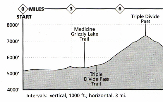
The hike length is 7.2 miles, making it 14.4 miles round trip.  The elevation gain is 2,380 ft to reach 7,397 ft at the pass.  Considering the mileage and elevation gain, this is not a difficult hike.  Once we branched off from the Medicine-Grizzly trail our climb was slow and steady with no switchbacks. I think the reason for that is because this used to be a horse trail back before the Park had roads when the tourists back then did their sightseeing on horses.  The trail has some rock work and has a similar vibe to the Highline Trail.

For a cloudless day, a Saturday, and a popularly rated hike (on most people's top three beautiful day hikes in Glacier Park), we saw few people on the Triple Divide Pass trail. Five people I believe.  The trail head parking lot was full so I believe the other people may have gone to either Medicine Grizzly Lake or Morningstar Lake.

Bad Marriage Mountain
Medicine Grizzly Peak

Two views of a mountain I do not know the name of.  Moon is visible over and left of the mountain.


I don't know the name of this mountain either - though I am calling it "Number 9".  In the background, in the center of the photo, is Triple Divide Peak.  The pass can't be seen here as it is to the right of the mountain right where it "meets" with "Number 9" in the photo.  I wrote "meets" as the two mountains are not near one another.


Views of Medicine Grizzly Lake and Razorback Mountain..


Patti and Gene


Even though it is August and getting dry, some wildflowers and snow were still around.


A few photos looking back down the Cut Bank Valley we hiked from.


Triple Divide Mountain is the mountain right of center.  The line of mountains is the Continental Divide.


The mountain on the left is Razorback Mountain.


What are Patti and Gene looking at?
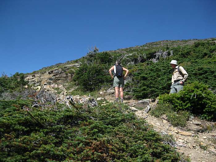

Oh.  Triple Divide Peak.


The view of Triple Divide Peak from the pass.  While Patti and Gene stayed back at the pass, I climbed up a little of the mountain and took the second photo from the highest point I climbed.  One can climb to the top of Triple Divide Peak, but the route is not in these two photos.


The view back to the pass.  The mountain on the other side is Mt. James.  I plan to climb Mt James the next time I am in this area.  Apparently it is another two miles to the summit of Mt. James.  Mt James, at 9,375 ft, is higher than Triple Divide Peak at 8,020 ft.


The view down the valley towards Red Eagle Lake (not visible in the photo).  As you can see the trail switchbacks down the valley from the pass.  I believe the mountain with the point is Little Chief Mountain.
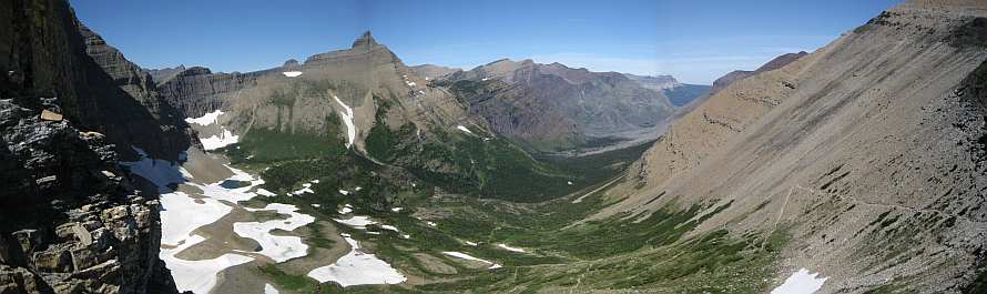


As you can see, the lakes are still mostly snow covered.


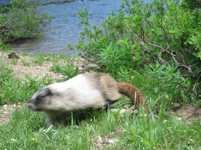
At the pass were several marmots and also several Columbia ground squirrels.  The marmots were aggressive.  When my back was turned when I was talking with another man who had also hiked up to the pass, one marmot came over and started chewing on one of my pack's straps in order to get the salt.  As you can see, later while I was eating, one marmot came right up to me before I shooed it away.


An unhappy marmot after I shooed it away from me.


After our hiked we stopped at the Firebrand Pass restaurant, which is located along Hwy 2 near Marias Pass.  The food there is excellent. We all got something different to eat and all really liked our meals. The restaurant wasn't as busy as the other time I ate there last year.

Tuesday, July 19, 2011

Medicine Grizzly Lake

Tuesday, July 19, I hiked six miles (12 miles round trip) to Medicine Grizzly Lake in Glacier Park with Joyce, Patti, Gene, Ivy and Jake.


As you can see there is not a lot of elevation gain to the lake.  To Triple Divide Pass... that is another story... and another hike.


The photos with hike734 on them were taken by Jake. Jake has a blog and a Facebook page.

http://www.hike734.com/blog/

http://www.facebook.com/hike734?sk=wall


At the start of the trail.  The mountain in the left is "Bad Marriage Mountain".


Bad Marriage Mountain

Medicine Grizzly Mountain and the North Fork Cutbank Creek.


Atlantic Falls.


Here are two short videos I took at Atlantic Falls.

http://www.youtube.com/watch?v=gCum1vEhyuo

http://www.youtube.com/watch?v=JZXONdZAWbg


Jake getting a picture of a frog.  Water is still on the trail.


This is after the point where the trail splits.  I am on the trail to Medicine Grizzly Lake (ahead).  The trail to Triple Divide Peak (the far pointy mountain on the right) goes up along the mountain side on the very right.  The far large mountain on the left is Razoredge Mountain.


Wildflowers.  Even though this is July 19, snow was still here.


Looking back down the valley from where we came.


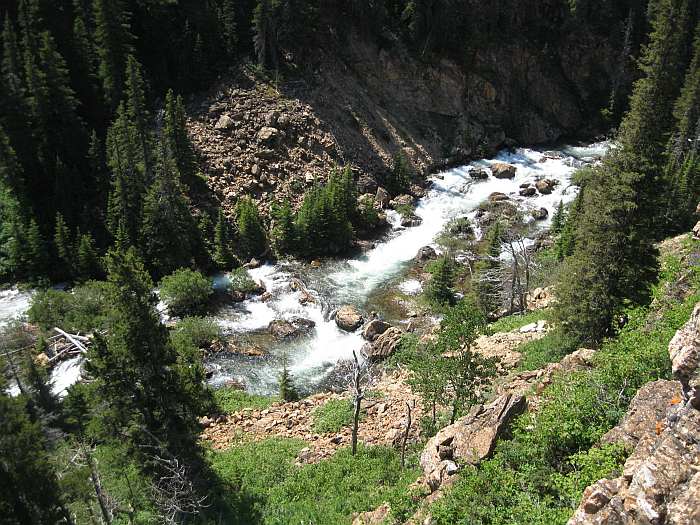
At Medicine Grizzly Lake, this is a stream from one of the waterfalls seen in the photo before the previous photo.  The logs in another stream (from the waterfall in the previous photo) was as far as we went.  We decided not to cross this stream.  There wasn't much further to go anyway.


Jake taking photos of waterfalls then a marmot.


The marmot posing for Jake.


The marmot posing for me - briefly.


The marmot was a bit of a pain.  One had to watch it at all times as it knew that people and packs meant food and it would circle around and around.  When we didn't feed it it would try to sneak up to our packs.

Jake


Patti can't resist going into lakes - no matter how cold the water is.


The Glacier Fund partnered with and sponsored Jake on his hikes. Here Jake is posing with "Billy Bowman", the Glacier Fund mascot, on his back.


Clouds started to come over the divide by the time we left the lake.  During the hike back to the car Jake planned to videotape and take photos of things he neglected on the hike to the lake.  Since Gene, Ivy, and Joyce had left the lake well before Patti, Jake and I, eventually Patti and I left Jake to film.  The clouds built and thickened as we hiked back to Patti's car.  Ten to fifteen minutes after we got back to her car the rain started.  It was a good rain and lasted a while.

During our journey home we drove over Going-to-the-Sun Road.  The road was only opened on July 13 this year.  This is the latest opening ever in the road's 78 years of existence even with all the workers and modern equipment available to clear the road of snow.

The mountain in the clouds is Heaven's Peak.  Near the right side of the photo is the end of the ridge and where Heaven's Peak Lookout stands.  The park planned in 2011 to restore and stabilize this historic structure originally built by conscientious objectors during World War II.  The plan was to start work the end of July and it would last until the end of August.  As you can see there was still a lot of snow on July 19.  The Park decided to postpone the work until 2012.

What happened to global warming?  According to the global warming believers Glacier Park's glaciers are suppose to be gone in a couple decades.  Kind of hard for that to happen when areas without glaciers are now having snow longer, and sometimes all year.  I know of a number of people who didn't hike Floral Park this year because the snow never went away.