
 Here are more photos from my Nov 10 hike to see the high water on MacDonald Creek in Glacier Park. These photos are of the Avalanche gorge, then the hike back to Lake MacDonald Lodge and Sperry trail head via the Avalanche Trail.
Group: Me, Bill, Joyce, Arnie, Sue Ann
Mileage: 5.7 miles
Time: 1 pm to 3:30 pm
We had walked on the Sun Road 5.7 miles until we reached the Trail of the Cedars. I suggested we walk along the Trail of the Cedars to Avalanche Gorge to see how high the water was running through it.
 The walk along Avalanche creek was cold! I hadn't been wearing my gloves this morning and now my hands were getting cold. The others were cold also.
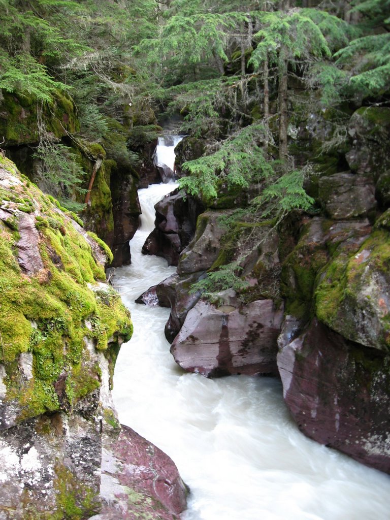
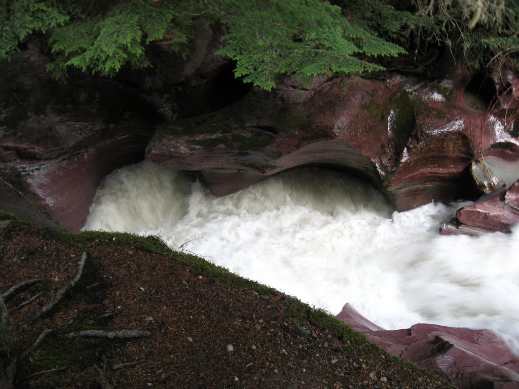
The group stayed at the bridge across the creek at the foot of the gorge and I went up upstream and above the creek to get more photos. The creek was higher but not as high as I expected it to be.
While it seems as if everyone who visits the Park is worried about bears, the most common way to die in the Park is by drowning. Last year a young woman fell in and went through this gorge and surprisingly made it through alive (though barely).


While checking out the creek upstream I noticed a trail through the forest that headed back to Lake McDonald lodge via John's Lake. Walking on the pavement is hard on one's legs, and I suggested we take the trail back to Bill's car. The group agreed as none of them had ever been on this trail.
Sue Ann's sense of direction was messed up and she had trouble understanding the direction we were going. While women tend to travel via landmarks and right/left, and men go by north/south/east/west, even Joyce understood where we were and where we were heading.
Sue Ann went over-and-over trying to make sense of where we were. Each of us tried to explain it to her but it wasn't making sense to her. Part of the problem was she was using right/left in describing how we walked along the Sun Road and how we were walking back. Right/left is subjective on which way a person is facing, and changes when one goes in a loop. That is why north/south is better to use. We all took turns walking near her to explain it, and turns walking in the back of the line to take a break from explaining it to her.
After we left the Avalanche Creek area the temperature got warmer; so I and the others took our gloves off. Bare hands certainly made photo taking much easier for me.
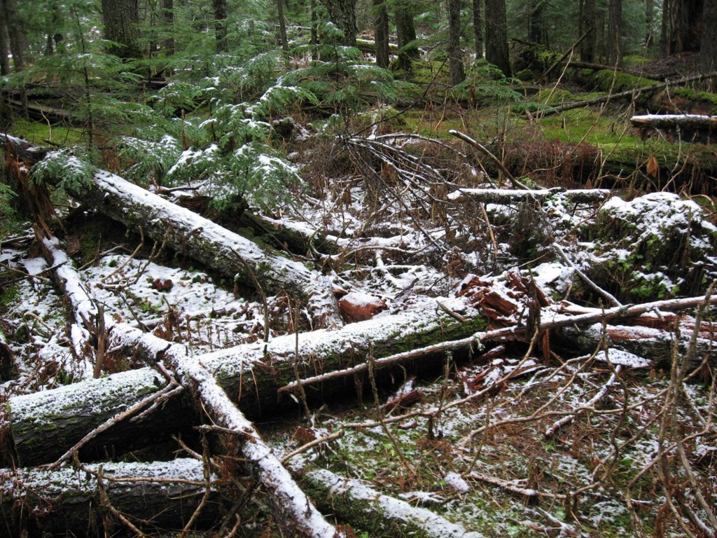
As you can see there was snow on some parts of the trail. There were also a number of trees across the trail. They were recent as the Park hadn't cleared them from the trail yet. We went over or under them as required. Can you believe Arnie (in the blue coat) is over 81 years old? That is what a life of hiking in Montana can do for you.


The trail had quite a number of good sized and/or interesting cedar trees along it.
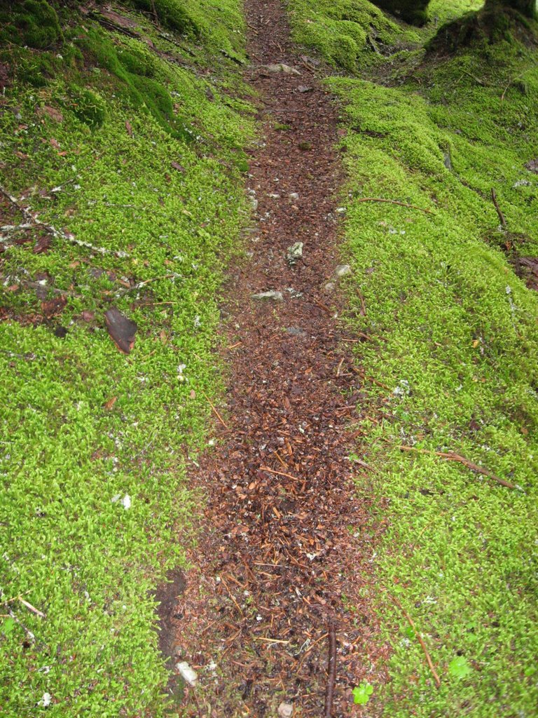
 The trail was a bright combination of green and orange cedar needles. Every so often there was a some area - usually a circle - of snow. The upper foliage was open enough to let the snow fall through but not open enough to let the sun melt the snow.
Even though the day was now overcast - and a random snowflake or two made its way down through the trees - the trail was brighter than if we walked along the Sun Road. The greenery made the hike bright.
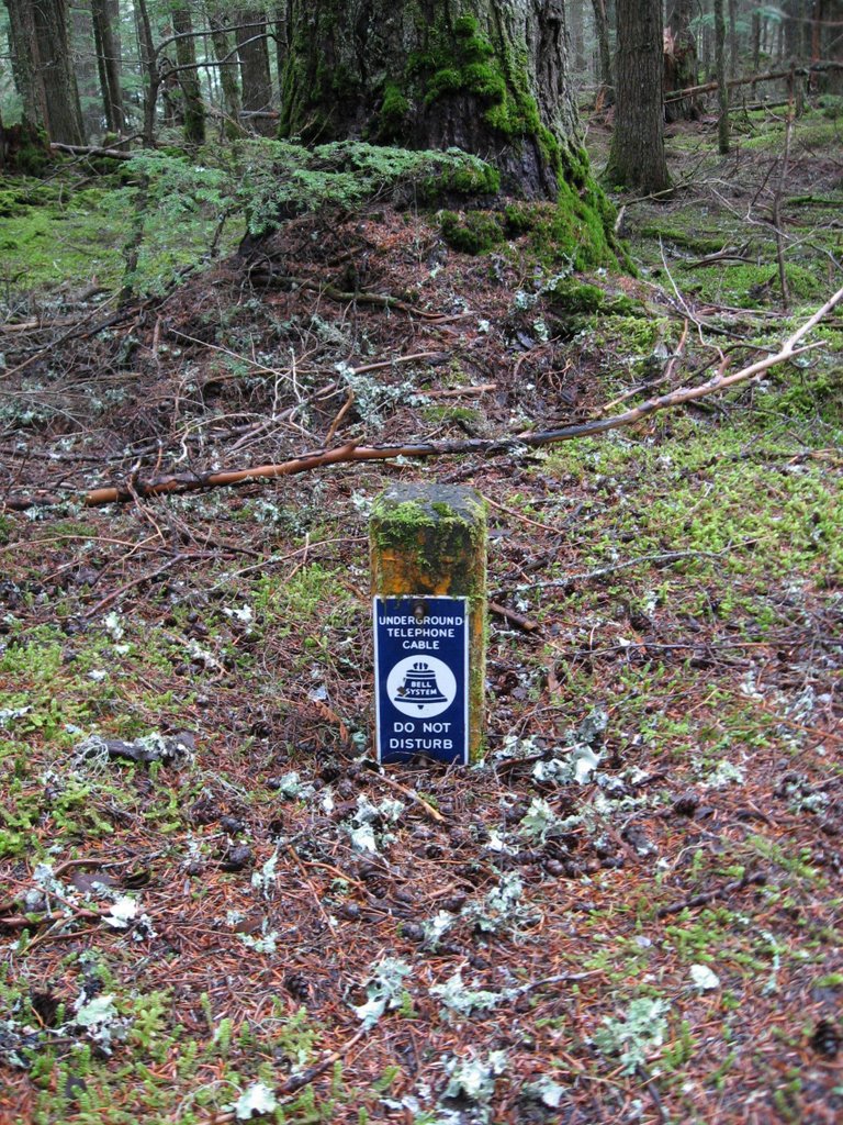
We also seen some small signs indicating an underground telephone cable. The sign had the old Bell company logo so this had to be from long ago. We were mystified that the Park hadn't run the phone line along the Sun Road in the ditch.

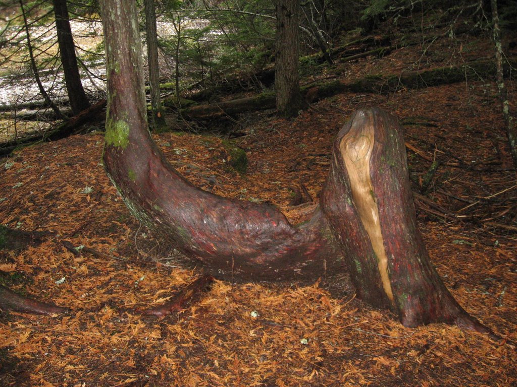
It turns out the group had hiked part of this trail before. They had hiked to John's Lake earlier this year, then back to McDonald Lodge. Earlier they weren't impressed with John's Lake, calling it John's Pond. Today the lake was larger, and initially they didn't recognize the lake. Only when Joyce spotted the odd tree (and also found a sign saying this was John's Lake) did they accept it.

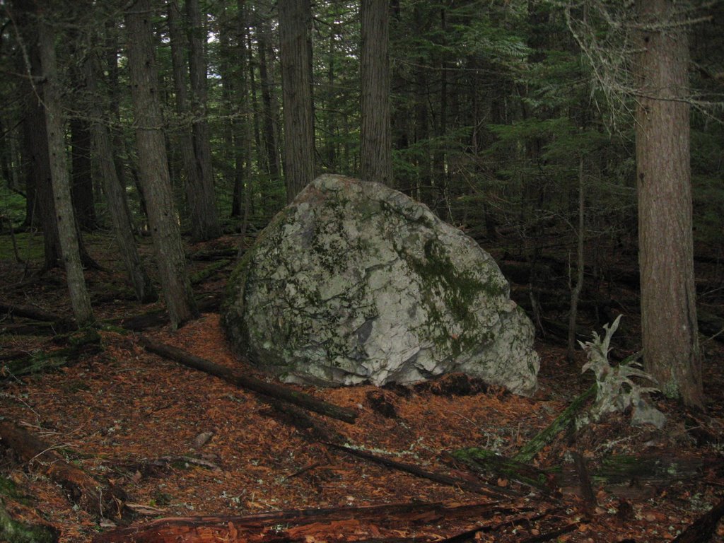
Near John's Lake was this interesting tree and several large rocks that looked out of place.

Eventually we reached the horse stables near the parking lot. All the animals were gone for the winter.
While the trail was very nice and it was an enjoyable hike, the return trip seemed to take far longer than when we hiked on the Sun road. Arnie had timed it and it took us almost the same amount of time each way.
Sue Ann had baked and brought brownies and we all ate one as a reward for our hike.
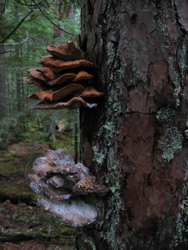
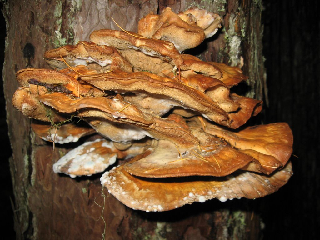
The following photos are of artist's conks. A conk is "fibrous but sometimes fleshy fruiting body of a wood-rotting fungus that has a definite form and structure".
Fungus invades tree through wounds, kills the sapwood of some species, and causes white rot of sapwood and heartwood in roots and trunks of a wide variety of forest and landscape trees. These form semicircular conks that are 2-30 inches wide and 1-8 inches thick. Upper surface of conk is brown and the lower surface is white, but turns dark when scratched, hence the name artist’s conk. Stalks are absent. Fungus can spread through natural root grafting. Conks are usually found near ground level, but columns of decaying wood can extend as far as 15 feet above and below the conk.
The difference in these photos is that I took one photo with the camera's flash on and the other with the flash off.


No comments:
Post a Comment