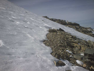
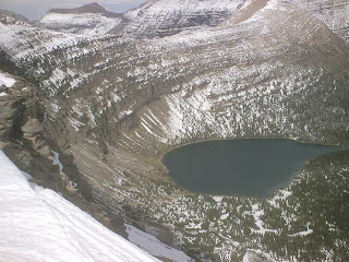
At Dawson Pass we now looked down into the Two Medicine valley and could see the Two Medicine Lake miles below.
We still had snow on the other side of Dawson Pass but as we dropped down from the top we dropped out of the wind. That was a blessing. The snow did not cover everything but I still used the snow to go down faster than just following where the trail lay under the snow. We had to make time. It was after 5 pm now and we had almost 6 miles yet to hike.
Because the trail dropped so quickly it wasn't too long before we were out of the snow. It seemed as if we had hiked half the trail in snow.
Photo 1: the south side of Flinsch Peak. From this side it looks easy to climb. Look at the previous posts to see the peak from the other three sides. I think I will return next year and climb it.
Photo 2: many layers of rock.
At a trail junction the sign said the distance to No Name Lake was .2 mile. I decided to hike to the lake. Joyce and Sue Ann continued back to the car. I was confident I would catch up to them as I had been hiking faster than them.
No Name Lake should be renamed. Maybe "Reflection Lake". The lake is not very big but the water reflected the views from all sides. I could see the rock mountain side to the south, the permanent snow field to the SW, the far off snow covered mountain to the east, Rising Wolf Mountain to the north, in addition to the trees along the lake. Very beautiful.
Photo 1 shows No Name Lake from near Dawson Pass.
Of the photos below, which is Rising Wolf Mountain and which is its reflection in the lake? Can you tell? You never know... I may have inverted some of the photos to make it more challenging.
Between taking a large number of photos I also spent time checking out the campground and environs beyond the lake. I spent more time here than planned, but well worth it.
From near the lake here are views looking back to Dawson Pass and then later a view of Two Medicine Lake. I had thought I would be closer to the lake at this point with all the hiking I had done.
I never caught up to Joyce and Sue Ann before they reached the car. In fact they reached the car almost 20 minutes before I did. They were determined to get off the trail before dark.
Through the trees I could see mountain tops to the east lit up by the setting sun. Once it became open so I could take a photo that light was gone. Then I noticed the clouds west over the Pass were a light rosy orange. Again trees prevented a worthwhile photo. Next I noticed the clouds above the eastern mountains were lit a fluorescent orange. Again I had trees in the way making a photo pointless. My timing was off. Sue Ann later said they were in an open area along the lake at this time and the lake was a beautiful red in the light.
At one point when I was along the lake I thought I heard a sound in the trees below.
"Hey bear. Hey bear!" I called out. No answer.
As I moved along I heard more sounds like some animal also walking along with me. The hairs stood up on the back of my neck. It was dusk, the time the wildlife comes out to eat. I kept walking and after a minute I no longer heard any more of the sounds.
A few stars were now visible in the sky and the trail was getting hard to see when it was in amongst the trees. Across to the SE end of the lake I could see lights from the campground store and employee quarters. Getting dark!
The trail head was actually at the campground end of a short spur trail that led from the campground to where the Dawson-Pitamakan loop started. I really watched for this short trail as I definitely didn't want to begin the loop again! I was able to make out the trail sign in the darkness. *whew!*
I couldn't tell where the car was until I got closer. It also helped that Sue Ann opened the car trunk to get something and I could see the trunk's light. Joyce's car was the only one in the parking lot. The two hikers still on the trail must be staying in the campground. Even if it would be a chilly night, a tent and sleeping bag and not a long drive home, seemed like a great idea.
Joyce and Sue Ann reached the car at 7:55 PM, and I at 8:15 pm. It took us 11 hours to do the hike. Our Gunsight Pass hike was over a mile longer and we did that hike in only 10 hours. Then again we had no snow on Gunsight Pass and less elevation to climb.
Joyce and Sue Ann were very tired. Me, not so much. So I drove Joyce's car back. Besides I usually stay up late and would be less likely than the others to fall asleep during the drive home.
All of our shoes, socks, feet and pants were soaked. Joyce cranked up the car's heater and it was a toasty warm drive home. As this was an unfamiliar car I drove 5 to 10 miles under the speed limit home. Even so we didn't see many other vehicles on the road and were only passed by two vehicles between Two Medicine and Columbia Falls. For those who are unfamiliar with the area, I believe this is roughly 75 miles.
The answer to my lake reflection question is that the third photo is the mountain itself.
Friday, September 28, 2007
Pitamakan Pass to Dawson Pass
From Pitamakan Pass we could see all the way out to the prairie far away down the long valley that we had hiked up. Lower Two Medicine Lake can also be seen in the first photo. The second photo shows Red Mountain on the left (northeast) side of Pitamakan Pass.
This following photo is taken near Cut Bank Pass. From the left is McClintoch Peak, Cut Bank Valley, Red Mountain, Pitamakan Pass, Dry Fork valley we hiked from, then Rising Wolf Mountain.
Across the ridge that is Pitamakan Pass we could see into the Cut Bank valley.
Directly below us - straight down in fact - in the Cut Bank Valley was Pitamakan Lake. It seemed as if one could cliff dive the thousand or so feet into the lake.
To our southwest rose Mount Morgan. The trail continued to climb up along its shoulder until it reached the saddle between Mount Morgan and McClintock Peak. Cut Bank Pass was below us on this saddle.
Pitamakan Pass was mostly free of snow but as we moved from the ridge we were back in snow. A few snow drifts were between us and the Cut Bank ridge. Sue Ann has a terrible fear of steep snowy sections. She said that years ago when she lived in Colorado she slid a thousand feet when skiing. So I took the lead and made tracks in the snow for her and Joyce to follow in.
When I reached Cut Bank ridge I could see into two more large, long, and deep valleys. The north one went west and the other one (south) curved from the south around north then northwest. Of course tall snow covered mountains were everywhere.
We had reached Pitamakan Pass sometime after 1 pm. It was now after 2 pm. We had miles to go and it would be dark by 8 pm. So we kept moving.
Now we were on the NW side of Mount Morgan. Usually more snow and deeper snow is on the north side of mountains, or on the east side of mountain ridges. We found more snow on the NW side. The mountain was steeper and the trail narrower with a long drop down the mountain side.
I was sure I could pick out the trail under the snow and headed off. Joyce and Sue Ann followed me with Joyce on occasion asking if I knew or was certain where the trail was. Yup.
The snow was soft except in shady areas. Therefore I could easily dig my feet into the snow as I walked. I would stamp down to make strong footprints for the others to follow as there were no other tracks except for an occasional mountain goat track. A few times the snow was so soft that my leg sunk deep into the snow, a few times up to my waist. It is hard enough getting one's leg out of such deep snow, harder still when one is on a narrow trail with a steep drop off.
Sue Ann was not happy with the trail and was very scared. Halfway through she temporarily lost it and thought she couldn't do it anymore. She had no choice but to continue and with our encouragement she pulled herself together and continued on.
I stopped every so often for them to catch up as I didn't want to get too far ahead of them that they felt abandoned. Their going was slow as Sue Ann leaned on her left hand for much of the hike along this steep snowy section. At least she and Joyce had gloves. I didn't bring any and for the very steep sections where the trail had completely snowed over, and had an extremely steep drop off, I leaned on my left hand. I tried to do this as little as possible as my hand got very cold.
At this point I thought we had reached the SW part of the mountain. Nope. There still was another section to go.
The first photo is the way forward. The second photo is a look back at the way we had traveled so far.
Finally the trail curved around to a SW point. No snow was on this point. I anticipated little snow on the south and SW side of the side of the mountain. Less snow, yes. But still more snow than anticipated or desired.
Photo 1 is the SW point.
Photo 2 is of the Nyack Lakes far below this SW point.
From this SW point I thought I could make out the trail across the mountain side. Joyce and Sue Ann weren't sure where the trail was. They let me go ahead and only came after I shouted back that this indeed was the trail. They were so happy to have me lead and break trail that they said they owed me and I could have most anything for doing this. Joyce had baked and brought a pie which was back at the car. She said I could even have two pieces of pie. Sue Ann made zucchini bread and said I could have all I wanted.
The red Xs mark the trail.
Looking back at the SW point once Sue Ann and Joyce decided to follow me.
In the first photo are snowballs created by snow rolling down the mountain on their own accord. We didn't see any snowballs being created as we passed by. There was not enough snow above us for us to worry about avalanches, thank goodness.
The third photo is a look back to the SW point and the way we have come since then. The photo was taken from the first saddle, between Mount Morgan and Flinsch Peak.
From the first saddle we could see back down on Oldman Lake, Pitamakan Pass, Red Mountain, the Dry Fork valley we initially had hiked up, and a western view of Rising Wolf Mountain. The red Xs show the trail from near Oldman Lake to Pitamakan Pass at the top of the ridge.
Two other hikers were following us. Joyce and I had seen them below us when we were hiking up to Pitamakan Pass. When they never appeared while we ate our lunch at Pitamakan Pass, or when we were on Cut Bank ridge, we thought they had gotten discouraged by the snow and had turned around. Before we left the SW point we saw them following in our tracks along the snowed covered trail on the NW side of Mount Morgan. They didn't seem that far behind so we watched for them as we hiked along the SW side of the mountain. No sign of them. Did they fall off the mountain or turn back? It wasn't until we were almost to Dawson Pass that we saw them back at the first saddle, the one between Mount Morgan and Flinsch Peak. We never saw them again. Considering it was dark by the time I finally reached the trailhead at the end, it would have been very dark by the time they got off the trail.
Depending on where we were the wind blew fiercely or hardly at all. On the ridges the wind blew strong and I held tightly on to my straw hat on my head, else held it tightly in my hand. If I lost my hat on the ridge overlooking Oldman Lake there was absolutely no way I would go looking for my hat.
Even when against Flinsch Peak, which was between the first ridge and the Dawson Pass ridge, the wind blew strong. I held on to my hat so the wind could not blow it way up and over the mountain top.
When along Flinsch Peak I found bear scat on the trail. No berries in this scat! It looked like hair or fur was in the scat. A short distance later I found large tracks on the trail. Other than mountain goat tracks on the NW side of Mount Morgan, we had seen no other tracks. This new set of tracks were bear tracks as I could make out a paw print at the bottom. It is hard to tell how large the bear was as the track could have melted larger. If the track had not melted larger, then the bear was a big bear.
Photo 1: we were surprised to find a caterpillar way up this high crawling on the snow.
Photo 2: an avalanche chute as seen from near the top. You can see why the snow slides down the mountains and out into the valley below taking out the trees.
Distances played tricks on a person. In both the NW to SW leg, and then the SW to south leg, the distance seemed far longer when we looked back at the way we had come. Standing on the SW point, the distance to the second saddle - Dawson Pass - seemed long, but not that long. Once we reached Dawson Pass the SW point seemed a tremendous distance away.
Photo 1: one of the obstacles to get around on our way to Dawson Pass.
Photo 2: when along the side of Flinsch Peak, a look back to the "SW point" of Mt Morgan.
Also along Flinsch Peak we stopped to eat as Joyce was feeling lightheaded. After a short lunch break we continued on and finally reached Dawson Pass. We were so happy.
A last look at the Nyack Valley before heading away and down Dawson Pass into the Two Medicine Valley. Mt Pinchot is on the left and Tinkham Mountain is on the right.
Next... Dawson Pass to the End.
Labels:
Glacier,
Hiking,
Joyce,
Sue Ann,
Two Medicine area
Subscribe to:
Posts (Atom)