

 It was only 4:30 pm after I had returned to the Logan Pass parking lot after my hike up to Mt Oberlin, so I decided to hike to and climb Haystack Butte.
This has been another one of my "must do" hikes, ever since my friend Darrel had hiked up here in 1997 after our backpacking trip.
Let's see... it is 4:30 pm now and the sun sets around 8 pm. 3.5 hours to do the hike. The distance... 3.5 miles one way? The Highline Trail is fairly level though I will have a climb up to the shoulder of Haystack Butte where I begin my climb in earnest.
Ya... I can do this hike before it gets dark. Or at least...before it gets too dark.


There weren't many people on the trail, and those who were on the trail, were returning to Logan Pass. No one was going in the direction I was going. Am I crazy for doing this now?


Haystack Butte is farther than it looks. I walked and walked and I didn't seem to be getting much closer. And the sun was moving lower in the western sky.


I started to occasionally jog. My day pack was lighter as I had eaten much of my lunch on top of Mt. Oberlin. Suddenly I heard a noise on the trail ahead of me. It turned out to be a large bighorn sheep I had startled. It ran up the trail and as I followed it eventually moved off the trail and stood and watched me as I passed.


The Highline Trail was starting to get in shadow as I approached the east side of Haystack Butte and began the climb to the saddle. A half dozen bighorn sheep were grazing nearby. As I began the climb around the side of Haystack I saw two mountain goats above on one of the short rocky cliffy areas.
Look at the photos and you will see Haystack Butte has a long meadow on its SE side on its upper half. The lower half is a steep cliff. The east side is steeper but passable without too much trouble. The SW to North side are all steep tall cliffs.
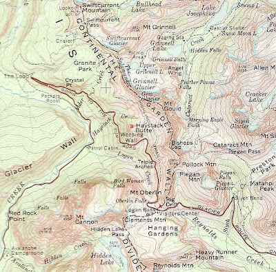
The red Xs mark the route I took when climbing Haystack Butte. The second photo shows the profile of Haystack Butte from the side shortly before I left the Highline trail to climb it.


There is no trail to the top of Haystack Butte. I had to judge the best time to leave the Highline Trail to begin my ascent and the best way to go through the rocky field and small cliffy areas on the east side as I made my way to the SW side. A few times I had to move down to get around a cliffy area. Later when I was back on the Highline trail for my return to Logan Pass I saw how my route was closer than I thought to the steep cliffs below the route on the east/SE side.
It was cooler in the shade. I hurried along as the shade meant the sun was dropping lower and sunset was ever so closer. Fleeting thoughts of turning around raced through my mind. I did not want to get stuck out on the trail after dark. Why didn't I bring a flashlight?! But I was determined to reach the top as this was my last chance to do so until next year.
 The SE meadow was much steeper than I imagined. The grass was thick, had wide blades and grew in clumps. It was harder to climb on the grass than on bare ground or rock. Whenever I spotted bare ground I made my way over there.
During my SE climb I was back in the sun. The problem was the angle I was at meant the sun was in my eyes. Sun = warm.
 Shade = cool.
  Sun = blinding.
  I wouldn't have minded shade during this climb as I was really working up a sweat. My route was straight up and I had to stop a number of times to rest and catch my breath. Why didn't I start my day's adventures an hour earlier? I could use that extra time right now.
The top is a long flat rocky ridge. I walked from the NE part where I could see the Highline Trail pass over Haystack's shoulder to the SW end where I could look down on McDonald Creek and valley. They were all in shadow now.


Further SW I could look back towards Flathead Valley. It looked to be filled with forest fire smoke. Coming to Glacier to climb the mountains today was a great decision. I noticed how the smoke was working its way up the McDonald Valley to the Loop on the Going-to-the-Sun road.


I looked back across the valley to Mt Oberlin where I had just been. Yes, it is high; and yes, it is steep with tall cliffs. Logan Pass, the Sun road below, and parts of the Highline Trail were in shadow. I could see the shadows move up the Garden Wall. Does a setting sun pick up speed as it sets?


I wanted to stay for a long time. Instead I ate much of the food I had left, and once that was gone, descended Haystack Butte. I was still in sun but that wouldn't last much longer.
 Now... what had been my path in climbing the butte? I had a few false choices where I had to move sideways when I came upon one of the short cliffy areas.
The grass was also a pain going down. One can't dig their feet into the grass when descending.
On the east side I didn't go as close to Haystack's shoulder when returning to the Highline Trail. I worked my way down the steep slope to the bend where the Highline Trail first approached Haystack Butte.
I never had the sun on me once I left the SE meadow. The Highline Trail was in shadow. I could see the Garden Wall change color as the sun's light changed as it set.


The big clear blue sky provided a long twilight so I had light to see during my hike back to Logan Pass. By the time I crossed the cliff section of the Highline Trail the traffic on the Sun road was few and far between, and visible via the vehicle's headlights.


On my return I came upon the same bighorn sheep. This time he was busy muching on a small shrub.


It was dark and the stars starting to come out when I reached the Logan Pass parking lot. My car was only one of three vehicles in the lot. A far cry from when I arrived at 1 pm to a packed lot.

One vehicle was nearby. A husband and wife and their active kids. I asked if they had just returned from the Hidden Lake overlook and they told me they were from Conrad, MT. They had just arrived at the Pass and were waiting to watch the stars come out. Eventually they wandered off to the visitor center even though it was closed now.
The occupants of the other car had headlamps which they used to light up the mountain goats and sheep who came into the parking lot to find and licked the spilled pop and beverages. The man wore a nylon coat and pants (for warmth?) and he made the "swish swish" sound as he walked across the parking lot to the garbage can.
After getting my hiking shoes off I stopped to watch the mountains all around get darker and go into silhouette. It was still and quiet except for the kids squealing and chattering at the visitor center across the far end of the parking lot.
I decided to leave before it got too late. It was now 8:50 pm. My hike lasted four hours.
It was completely dark now and in my car's headlights I saw the rock cliff rise on my front and right as I worked my way through the many curves.
I met only a couple cars, and after seven miles of downhill and curvy road driving, I reached the first stoplight for the road re-construction work.
The second stoplight seemed to be stuck on red. As I only had seen four vehicles total on my drive down, I started through the second road re-construction area before the light changed. At the other end I found several cars waiting on a red light. Oh!
It was a long drive out of the Park. The road is in McDonald Valley lined by tall mountains. There was no moon and the tall trees that lined the road make it even darker. I met only a couple vehicles, else I was alone in the dark world.
It is 60 miles from my front door to the top of Logan Pass. The curvy mountain road, the curvy road along McDonald Lake, and the 25 and 40 mph speed limits, meant I didn't get home until 10:10 pm.
Ah... but what a fantastic day! The Sun Road over Logan Pass is now closed for the year so this day has to last me until next year when I can re-climb these mountains.

No comments:
Post a Comment