
- Glacier Park (Red Eagle Lake)
- Southern Swan Mountains - with a good view of the Mission Mountains (Upper Holland and Sapphire Lakes)
- Northern Cabinet Mountains (Cedar Lakes)
- and now the southern Cabinet Mountains with this hike to Mt Headley.
I don't remember it taking us almost three hours to get to the trailhead. Between the company present and the drive along the Clark Fork valley from Plains to the trailhead must have warped time.

The hike was 8 miles long round trip. We started our hike at the trailhead at Vermilion Pass where there was plenty of area to park your vehicle. At Vermilion Pass the elevation was 6026 ft. Mt Headley is at 7429 ft. The elevation change was 1403 ft. Mt Headley ranks as the 1266th highest mountain in Montana.

Prominence is defined as the elevation of a summit relative to the landscape surrounding it. Apparently Mt Headley is ranked #27 in prominence in Montana with 3716 ft of prominence. I didn't remember Mt Headley being so prominent - maybe because we started the hike so high and only had 1403 ft of elevation gain. Then I remembered looking down on a small plane flying below when standing on Mt Headley. I have a 10 second video of that. https://youtu.be/q2kwOiRS_Vg
I got this photo from the Internet.

As we drove to Vermilion Pass we passed by this waterfall. I am not sure the creek's name. Maybe Graves Creek?


Here is a 27 second video of the falls: https://youtu.be/tzO0NrZFiuM
 |
| The view off to the northern side at the start from Vermilion Pass. |

The trail forked here. With no signs we weren't sure which way to go. This is the view of the left fork. This was not the trail to the top of Mt Headley. If you look back to the photo with the labels "start" and "Mt Headley", I believe the following photo view is the same as the snow covered mountains on the left side of the earlier photo.

Mt Headley is the high point on the right side of the following photo.

Patti and I had hiked to Cabin Lake in July 2015: http://tallpineshiker.blogspot.com/2015/07/cube-iron-mountain-and-four-lakes.html


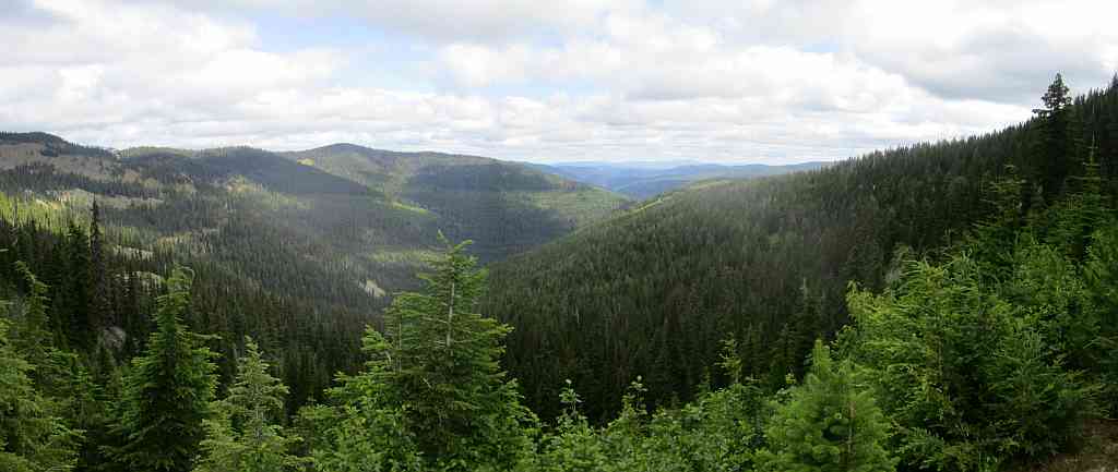
Views from the top of Mt Headley.


Looking NW towards the Cabinet Mountains Wilderness area. Earlier in the week Patti and I were at Cedar Lakes in this area and I don't remember the mountains being so tall.

 |
| Apparently this is a lookout on top of Priscilla Peak. |
Too bad Patti moved away. If she was still here the Priscella Peak lookout would have been a future hike for us. That is how we explored the Whitefish Range: hike to the top of a mountain, look over at another mountain, see something and plan a future hike to that mountain.
Parts of the trail were brushy. The brush was still wet from the previous night's rain. Patti is wringing out her soaked socks once we were at the top of Mt Headley. Patti had a second dry pair of socks and on the hike back down the mountain the brush was dry.

Joyce. A pretty good hiker for someone around 80 years old and who had knee replacement surgury back in January.

Here is a 57 second video of the views from the top of Mt Headley: https://youtu.be/yqmdTJMRu_M
For more (better) photos of Mt Headley: https://montucky.wordpress.com/tag/mt-headley/

No comments:
Post a Comment