
Where to go? With all the fires it is smoky. Parts of Glacier Park are closed due to the forest fires there, and the Park is still busy with people. I figured Baldy Mountain is south and west of all the forest fires and wouldn't be as smoky. And in the morning that looked to be true. But there are forest fires in Idaho and with the heat in the afternoon it got smokier and smokier. So views were not as good as they should be.
 |
| The driving route from Kalispell |
Directions: In Plains turn onto Clayton Street and stay on that paved road nearly to its end. At a fork in the road, leave the paved road and turn left on a Forest Service gravel road with no marker other than a small sign with the number 2 on it. Follow this road for several miles, turning right at a narrower road with the little brown sign with a white hiker symbol on it. Stay on this road until you see the trail head sign, where you'll park.
 |
| The driving route from Plains, MT to the trail head |
Once we were driving on the narrow road we saw a yearling black bear run from the left onto the road a short distance before crossing off to the left. All of us were surprised and no one had a camera ready, so no photo of the cute little bear. We were all glad to be in the car.

 |
More of a 3D view to try to give you a sense of the elevation change.
|
According to the signs the distance is 2.6 miles one way, for a total of 5.2 miles. My Garmin Etrex 30 GPS has the distance as 5.7 miles. But something is suspect. The two halves should be a mirror image and they are not. Leah developed knee pains and at around the 2 mile mark stopped climbing. Joyce and Cheryl continued to the top while I stayed with Leah as I have seen the view from the top before. I sat on a log and ate a lunch as I kept Leah company. The chart seems to have continued to (erroneously) record movement during this time of sitting for about a third of a mile based on the flat part of the chart.

"Offically" I had read that the starting elevation is 5900 feet and the top is 7400 feet for an elevation gain of 1500 feet. My GPS had us starting and ending at around 5400 feet and the top was a little over 7400 feet for an elevation gain of a little over 2000 feet. In this I am a little more trusting of the GPS.
Three years ago I had hiked this trail with Patti. (http://tallpineshiker.blogspot.com/2015/08/baldy-mountain.html) We had hiked (climbed two mountains that day); both in almost equal distance and elevation gain. We both felt the Baldy Mountain climb was harder. We put that down to Baldy Mountain being the second climb of the day. Now I suspect Baldy Mountain does have a higher elevation gain.
As Joyce and Cheryl were returning I continued the climb to the top while the three hiked down the mountain back to the car. After seeing the view from the top I caught up to them before they reached the car. On the hike down the mountain Leah's knee felt better, but her ankle was now bothering her.
Also on the hike back to the car I learned Joyce and Cheryl hadn't walked to the south end of Baldy Mountain. From there you can look down on Baldy Lake.
Everyone said they enjoyed this adventure of a hike even if it was a bit disappointing to have smoky views; and Leah was disappointed not to make it all the way to the top.
Here are photos from the trip. Use the link to the hike with Patti to see how the views are smoke-free.
 |
| Trailhead |

 |
| Thompson Peak to the north in the background. |


This is new since the hike I did with Patti. The last half mile of the hike is over rocks. Someone found a rock that looks just like an axe and placed it in rocks at the corner of a switchback.


 |
| Old remnants of a lookout? |
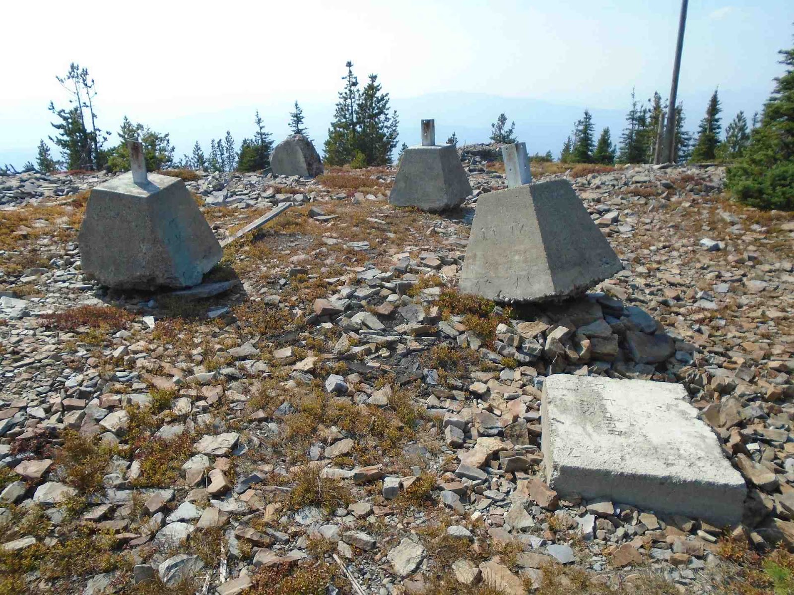 |
| It appears there may have been a newer lookout at some time in the past. |
This is also new since Patti and my hike. Someone had time to play with rocks. The rocks were placed on what looks like to be concrete that was spread out rather than hauled back down the mountain. Why the concrete... I have no idea. The concrete was nearer (west) of the original rock lookout foundation.

I believe this smoke is from the Garden Creek fire. The fire was started by lightning on July 29 and was 100% contained by August 22.


 |
| Baldy Lake |

No comments:
Post a Comment