
 A week ago Friday I hiked to Iceberg Lake in Glacier Park with my hiking group.
Roundtrip: 9.8 miles
Elevation gain: 1200 ft
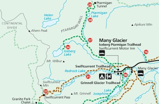
Region of park: Many Glacier
Link to interactive Glacier map: click here
It was an early start to the day for me as the meeting time was 7 am. I was awake and out of bed before the alarm clock went off and ready in plenty of time for Joyce and Edley to arrive.
6:45 am - no one. 6:46 - no one. 6:47 - no one. They are always on time. I called and found they weren't coming on the hike today. Yikes! Joyce hadn't mentioned this when I spoke with her the previous night about the hike.
I had to rush to the meeting place in Columbia Falls and only had minutes to do it. I wished the speed limit was higher. I arrived a few minutes after 7 am and everyone was still there. Whew!
The group today was:
- Arnie
- Bill
- Edwina
- Bridget, Edwina's neighbor
- Barbara, Bridget's friend from Seattle
- me
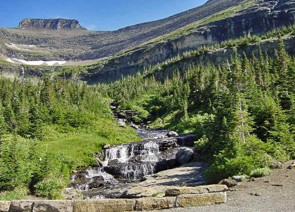
The drive over Logan Pass was cloud free. The mountains were lit by the morning sun. This is a sight I don't remember ever seeing before. "Yawn! Who gets up this early?!"
At Logan Pass the men's bathroom was closed for cleaning so us guys walked above the visitor's center to look at the mountains in the morning light and talk about the Dragon's Tail trail and other routes not on official maps while waiting for the cleaning to finish.
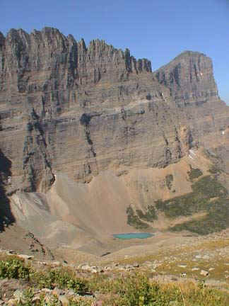
Here is an aerial photo of Iceberg Lake. The trail enters the photo just above the lower right corner, above the stream. The trail goes NW across Ptarmigan Falls to almost the top center of the photo before turning west, SW, then south to Iceberg Lake.
While you can't see any icebergs in the photo, trust me, this is Iceberg Lake.
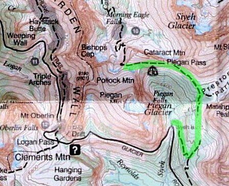
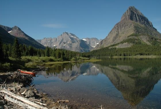
 The first 2.8 miles of the trail was the same trail we hiked on to Ptarmigan Tunnel a few weeks ago. No matter, the Many Glacier views may be the best views in the entire park and I enjoyed seeing these mountains and valleys again. In the sunlight we could even see a bump glinting in the morning sun that is the lookout on top of Swiftcurrent mountain at the far end of the main valley.
  Yes, those wires on the lookout are needed. The one time I hiked to the lookout it was very windy. As I leaned into the strong wind I saw a spider crossing the trail. It also moved slowly, keeping most of its legs on the ground.
I got into a bit of hot water when I mentioned someone (not part of the group) who was getting elderly. "What do you consider elderly?!"
"Umm.. people in their 70s."
Opps, wrong answer. I forgot all my hiking partners are in their 70s, with Arnie being 81. They are such strong hikers I forget their age and think of them being closer to my age. My hiking friends consider elderly as being 85 or greater.
Three men and three women were on this hike. Who do you think the hunters were? The women all hunt and none of the men. Having hunters on a hike is a good thing as they are the people who spot the animals. Edwina found all the mountain goats and bighorn sheep and was first to spot the bears.
At one point in our hike Edwina wondered if the shape in the valley below was a bear. We determined that it was a "rock bear". A young Japanese couple came up as we joked about the rock bear and in broken English wanted to know where the bear was. I explained rock bears are the kind that don't move.
Where the Iceberg and Ptarmigan trails split, we saw an actual ptarmigan cross the trail to go to the Ptarmigan trail. While Barbara took a photo of the ptarmigan the Japanese couple caught up to us again. Now they were unsure of us "Crazy Americans" so I had to point out the ptarmigan to them as it made its way into the brush on the side of the trail.
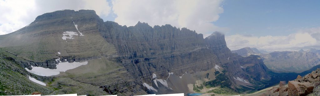
Shortly after the two trails split the Iceberg Lake trail exited the trees and traversed the southern side of the Ptarmigan Walls mountains. It is a gradual incline as the trail goes west then curves to the south and into the high cirque.
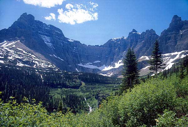
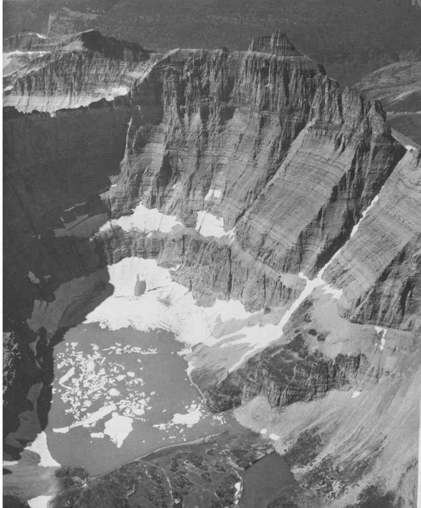 The lake is surrounded by very high mountains on all sides except the north side. On the west side there was a "notch" between two mountains. Snow was still in parts of the notch. If one was very adventurous - and a little crazy - they could climb over the notch. The "notch" can be seen in the photo where the snow goes up on the right side.
On the SE side there was a lone mountain goat high above on the steep rock mountain side. It stayed in one place with its head down. What possibly could it find to eat up there? Who knows!
 Not many people were at the lake - but there were more than on my other Glacier hikes. A family from Great Falls said when they were here during the summer there were 200 people at the lake. That would be over crowded. I guess the couple dozen people today wasn't that bad after all.
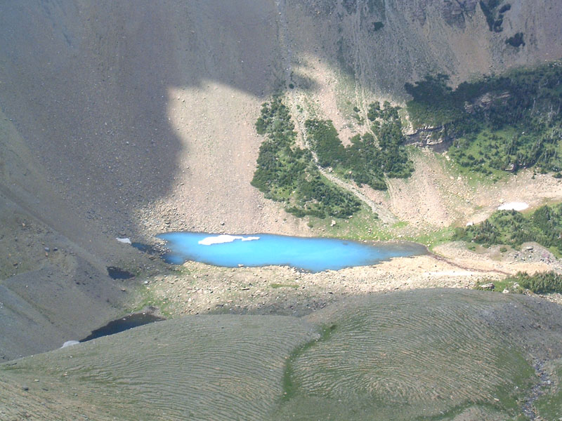
There were a few very small icebergs floating in the lake. One looked like a swan. The lake should be called 'icicle lake' or 'ice cube lake as none of the floating ice was very large.
Arnie and I were first of our group to reach the lake and we found a few "comfortable" rocks along the shore on which to sit and have our lunches. After a bit the rest of our group arrived with a few other people and a female ranger.
The ranger told us about two black bear yearlings back below the trail. Arnie and I missed seeing them. The yearlings were on their own as their mother kicked them out this spring. They were thin during the summer but now are gaining weight as they realized mama wasn't going to help them anymore and they now had to look for food on their own. The Park rangers kept an eye on them this summer preferring not to haze them away from the area so as not to stress them further.
Barbara had a bad blister on one foot. Bill and Edwina had extra bandages and some Advil for her. Bill joked his name, William, means "protector of woman". Guess so.
The women took off their shoes and soaked their feet in the shallow edge of the lake where it wasn't so cold. After I finished my lunch I took off my shoes and waded into the lake until the water was above my knees. The group warned me not to fall in. The rocks were not slippery. It was cold and my legs and feet were numb after a few minutes.
After I came out of the lake a teenage boy and two girls from a nearby family dove in. With shrieks and loud gasps they quickly came back out.
As we hiked back Barbara told about her 5 week African safari. Bridget and her brother own homes in Mexico. Hurricane John damaged Bridget's home and destroyed her brother's home. I meet such an interesting variety of people on my hikes.
It was warm now and Bridget set a fast pace to get back to shade. We were passing a number of people on the trail.
Later we passed a couple where the man was fiddling with his pants. Bridget joked and told him not to take his pants off till we all passed as no one wanted to see him naked. As I passed I could hear him say something in a foreign language and he sounded annoyed. I'm not sure if he understood Bridget's humor.
Towards the end of the hike we could see clouds forming and getting bluer over the mountain range to the north. Fortunately the clouds stayed in the Belly River region on the other side of the mountains and never threatened us.
As we were driving out of the Park cars lined the road in one spot with people pointing. A sure sign of something. It was black bears, a mom and two cubs.
A short drive later and more cars and pointing. We stopped to find a female grizzly and her two cubs. She was large. Her head and neck were brown with a dark brown stripe near her front legs up and over her back. Behind the stripe her back was close to white. He rear half was a very light brown. One cub was dark brown and the other almost white. They meandered along the mountain side. Looking for berries.
Then it was off to the Park Cafe in St. Mary for blackberry pie. Today there were seats available as it was after Labor Day and not as many people in the Park.


We stopped at the St. Mary Glacier Park visitor center to check the trail status around St. Mary Lake. Bill wants to hike around the lake. The trail is closed due to the Red Eagle fire. The fire burned down to the lake in some spots and they closed it for the year so trees do not fall on anyone.
It rained lightly as we drove over Logan Pass. In front of us was one of Glacier's red tour buses with an open top. The people sitting inside were holding stuff over their heads to keep the rain off. The rain was short lived.
Back down in the valley more cars on the side of road with people leaning out of windows to take photos. We saw tree branches whipping about. We then saw a medium sized black bear in a tree eating chokecherries. After we stopped the bear climbed out of the tree and left. Edwina got a photo.
That made seven bears that we saw in one day, and two more bears that we didn't see. A good day for bear viewing.


