Showing posts with label Rocks. Show all posts

Sunday, August 4, 2013

Krag Peak

Going through old photos and I put together another hiking post...

Sunday August 4, 2013 Patti, Gene and I hiked to the top of Krag Peak.  Tammy was in Minnesota attending a Tastefully Simple business convention.
Krag Peak 7510', is the highest of a trio of peaks that sit relatively close to one another in the northern Whitefish Range of NW Montana. Next to, and just to the south of Krag, lies Krinklehorn Peak 7411', next to and to the SW of Krinklehorn lies Deep Mountain 7406'.
Krag Peak is located up near Fortine and Eureka, Montana.


This is the route we followed:
From downtown Whitefish drive 43 miles north on Hwy 93. 
Turn right onto Grave Creek Road and drive 3 miles until reaching Stoken Road and turn right again. 
Proceed on Stoken Road for 1.47 miles until reaching Forest Service Road #7019 (Williams Creek Road) as it angles in from the right. 
Proceed on FS Road #7019 for 3.86 miles until reaching the parking area at the trailhead.


It was a beautiful day: not too cold, not too hot.  Mostly sunny with a few clouds, more clouds as the afternoon went on.  I would have lingered longer on top of the mountain but Gene and Patti were concerned about the clouds and whether we would be rained on as we had over 5 miles of hiking to get back to Patti's car.  We stayed dry.

To get to Krag Peak we hiked on Krinklehorn Trail.


Krinklehorn Peak

At the saddle north of Krinklehorn Peak, the Krinklehorn Trail continues down the other side.  To get to Krag Peak one must leave the trail at the saddle and bushwhack over a half mile up to Krag Peak.

The bushwhack doesn't look too bad, does it?


Yes, the bushwhack is steeper than it looks in the previous photo.


Krinklehorn Peak, from almost half way on the bushwhack to Krag Peak.


Krag Peak is in the distance.  Note the lower open area below the top of Krag Peak.  A later photo looking back to this spot was taken there.


Bushwhacking up Krag Peak.


Looking back to the open area at the top of that peak where I took the earlier photo.  Also, to the right of this small mountain is the saddle (behind the dead triple trunk tree) where we started our bushwhack.


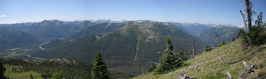
From the top of Krag Peak.   Eureka Montana, and beyond Eureka is Lake Koocanusa (the small sliver of water just above the mountain ridge top right of center).


The next two photos are an area shown via Google Earth in the third image. 


Here are more photos from my hike:

https://plus.google.com/photos/109566462412251958234/albums/6082913728233310929?authkey=COOtx9CfvZ-FtAE


More info on hiking to Krag Peak: http://www.summitpost.org/krag-peak/747508

-

Saturday, August 6, 2011

Elk Mountain in Glacier Park

Saturday, August 6, Patti and I hiked up to the top of Elk Mountain in Glacier Park.  When I say "up" I mean UP!  I climbed 3146 ft over 3.7 miles with 99% of the elevation gain in the last 2.5 miles. That's over 1250 ft each mile of the 2.5 miles. Or (if I have my math right) about a 23.6% grade. I think this is the steepest trail in Glacier Park.

In this topo map, we started near the little brown huts along Hwy 2.  We hiked 1.2 miles to the top brown hut which is the Fielding Patrol Cabin.  From there we turned right and went 2.5 miles up to the top of Elk Mountain.


Because the temperature was forecast to be in the mid-80s under a clear sky, we got an earlier than normal start.   That was good as it was a cool morning.  When I got out of bed it was foggy from the rain we had the previous evening.  The fog quickly burned off.

Our early start was a good idea as when we descended mid afternoon I was warm and sweating - more so than when I climbed up.  Keep in mind going down was plenty hard.  The trail was so steep that I had to work at slowing down and not losing control.  Making that harder was a good part of the trail was loose gravel on hard ground - not an ideal surface for going down a steep trail.

A van with South Dakota license plates was parked near the trail head.  We never saw these people so I believe they were backpacking on the Fielding - Coal Creek trail.  Near the start of our descent we met three women and and one man hiking up Elk Mountain.  They were from Whitefish and we saw their Subaru car when we got back to the trail head.  They were the only people we met.

Blue Grouse

A couple photos showing the trail.  It is hard to capture how steep the trail is.


There were still some nice wildflowers growing on the mountain.


Views towards Snowslip and Running Rabbit Mountains in the center of the photo.  To the right is Scaplock Mountain.  All the mountains I named are in green.


A better view of Scaplock Mountain is on the right. We could see the lookout when using binoculars. The Scaplock lookout is above the white spots on the green mountain, just right of center.  I've been up Scaplock Mountain twice: once in the Fall and once on snowshoes February or March 2010.  The water at the bottom of the valley is Ole Creek.


This view of Scaplock Mountain shows how steep Elk Mountain is.


Nearing the false summit.


Elk Mountain top as seen from near the false summit.


Climbed some more and still not much closer.  Trail is steep.  The very strong wind didn't help.


The view at the top.


In case you overlooked it, this is the location of the old lookout.  Glacier Park built the lookout in 1930 and destroyed it in 1963.  Not much area at the top of Elk Mountain.  The lookout took up most of it.


Little Dog Mountain.


Sheep Mountain. Brave Dog Mountain. And more.  The trail at the bottom of this valley eventually leads to Ole Lake, then Firebrand Pass to the right of the photo, and Scaplock Mountain to the left of the photo.


You may have noticed it sticking up in the background of several of the earlier photos... Mount St Nicholas.


A number of trains came by when we were on Elk Mountain.  The trains were very long and mainly carried shipping containers.  Click on the photo to get a larger view to see the train going around the multiple bends.  The engineer can't see the end of the train.


It was windy at the top, but not as windy it had been between the false summit and the top.


Another person's description and photos of Elk Mountain: http://www.summitpost.org/elk-mountain/425406

Jake, who I hiked with last month, posted a 3 minute video of his hike up Elk Mountain earlier this year: Jake's video.

Tuesday, June 3, 2008

Lupine Lake and Ashley Mountain

Friday June 6, Joyce, Bill, Gary and I hiked to Lupine Lake and then up to Ashley Mountain.

It was good seeing everyone. This was my first hike since I returned to Montana. And it was their first hike of the year also as they hadn't gone on any hikes without me.

A half mile or so in from the trail head is an overlook of a beautiful waterfall on Griffith Creek.


Photo 1 is looking up at rock. The right side is where I first saw the waterfall.
Photo 2 is the bridge crossing Griffith Creek.


Lupine Lake is a nice lake and we stopped and ate our lunch here. It seems as none of the sources agree to the distance to the lake, but I tend to believe the sign at the trail head: 2.5 miles.


We were all feeling good so we decided to hike to the top of Ashley Mountain. It was only another 2.5 miles. The following is a photo of Ashley Mountain taken earlier from the overlook of the waterfall.


For a while a stream that fed into the lake was near our trail.


Later, near a bend in the trail, we came upon this wooden marker.

In Memory of
Beloved husband
"Daddy"
Grandpa
Richard V. Bain
Nov 5, 1978

We stopped and studied it. We still have no idea if this is just a marker, or if it is a marker for an actual grave site. I believe Gary said it wasn't until sometime in the 1980s when it became illegal to bury bodies out in the woods.

Apparently I had not recharged my camera's battery in a while as once I took a flash photo of the grave marker my camera died and I was unable to take any more photos.

After the marker, the trail began a noticeable climb upward. Because time was passing quicker than we realized, and Gary had an appointment later, he and I continued ahead while Joyce and Bill followed. We still took time to move the small deadfall off the trail as we hiked.

The weather was a mix of sun and clouds. We crossed a gravel road/path, and while it was sunny where we were, we could see clouds and moisture to our west. A sign said we had one mile to the top.

Soon after crossing the road we came upon patches of snow on the trail. I was in the lead and tried to find areas of least snow to cross. Eventually that became impossible as everywhere was snow. Wet snow. Fortunately not deep snow.

We debated whether to continue and did so since I felt were were close to the top.

And we were. The mountain top was rounded and flat and was surrounded by thick trees. We had no view. The better view was near where we had earlier crossed the road.

At the top there was a large metal squat square structure with an antennae sticking up. The structure was weighed down by a collection of large rocks in a metal wire basket on each of the four legs. We could see anchor points in concrete on the ground that was used for the previous structure.

Then it began to snow. Heavily. For a while we took shelter under one of the large pine trees before deciding to return down the trail. Gary was interested in taking the road from the structure back down to the place where we had crossed it earlier. While I would have liked to have done so also, I reminded him that Joyce and Bill may be on the trail above the road and we would miss them.

Between the snow and the trees we couldn't find where the trail started down. Odd, we just came up it. Gary thought it was further left than I did and after failing to find it in that direction I came across it to my right.

It was a good thing we took the trail back even though that meant crossing all that snow: Bill and Joyce were a half mile from the top when we met them. Because there was no view, and snow was covering the trail, we all decided to return down the mountain. The falling snow ended by the time we crossed the road again. The tops of the trees were swaying, and we could hear the wind, but could not feel it.

There was an interesting tree stump that Gary took a fancy to on the way up the mountain. On the way back I picked it up and carried it for Gary. This was partly thanks for him carrying a good sized rock I fancied on our Elk Mountain hike when my hands were full with other rocks. And partly because I hadn't been bewitched by any rocks on this hike.

Gary and I traded carrying the stump to Lupine Lake. From Lupine Lake I carried the stump a half mile until I remembered leaving a rock when Bill and I hiked this trail last year. Sure enough I found the rock again. And being a nice rock (the photo doesn't do it justice) I couldn't resist it. That meant Gary had to carry his stump back to the car himself.

I had two miles to carry this rock. Down, then up a steep climb at the end. I began doubt the wisdom of carrying the rock. Once I got home I weighed it and found it to weigh 42 lbs. No wonder I got a workout carrying it.

Even though we were carrying items, Joyce and Bill had lagged behind. We waited for them to catch up. I went off trail to take a bathroom break. As I picked my way through the trees I put my hand on a large dead tree trunk and over it fell with a loud crash. I hardly touched the tree, I swear!

As we continued I went slower because Bill was lagging even more. He was tired. I found out he was out of food so I gave him some of mine. As we began the final climb upward I discovered Bill was out of water so I gave him half of mine. Shortly thereafter Gary returned and he helped Bill up the trail as I went on ahead.

Joyce was at the car and gave me some of the bread she had baked. I noticed an interesting large rock on the ground near the car and decided it would be a worthy addition to my rock garden. Once Gary returned with Bill he thanked me for loading the rock into Joyce's car for him. He had found it on the side of the road while waiting for Bill and I.

For the drive back home we went north through Star Meadows and near Tally Lake. We passed through some of the Brush Creek fire burn area from last Summer. Some of the dead trees were being logged and we passed a few piles on the side of the road with signs saying no firewood cutting of these logs.

Some of the roads didn't match the map I got from the Tally Lake ranger district. According to the map we should have come to the east side of Star Meadows, but we came to the west side. Okay... I'll remember that in the future.

While we started our day's activity at 9 am, and only hiked 10 miles, it was now 5 pm when we returned to our vehicles. Where did the day go?

Tuesday, October 16, 2007

Elk Mountain in the Fall

Tuesday October 16 I hiked to Elk Mountain.

The weather forecast had a cold front arriving Tuesday and rain starting in the afternoon or evening. This weather would be with the rest of the week. Joyce wanted to hike Tuesday before the front and rain prevented us from hiking.

After much deliberation we bypassed hiking in Glacier Park and I suggested we hike to Elk Mountain again. Bill, Arnie, and Sue Ann had never hiked there. So it was agreed.

On the highway map to the right, Elk Mountain is right of center, below the "C K" in "ROCKY". Look for the blue arrow.


The "Tally Lake" map below is the forest service map.


When Gary, Joyce, and I hiked to Elk Mountain in the Spring, we hiked trail 258 to get to trail 252 that went to Elk Mountain. It was 6.5 miles one way to get to Elk Mountain. On that trip we saw a sign saying it was only 1/2 mile from trail 252 to Forest Service road 9528 and 2 and 1/4 miles to Elk Mountain. A shorter way to hike to Elk Mountain next time. Or so we thought.


After hiking to Elk Mountain Tuesday several of the group has a suspicion the distance was greater than 2 and 1/4 miles. They timed our journey back. We compared our time to hike the half mile from the Elk Mountain trail to the 9528 road, and also the part of the road that was marked at 1 mile. In each case our time put us hiking at 3 mph. Taking our speed and the time we hiked, we estimate the 2 and 1/4 mile section is closer to 3 miles as it took us an hour to hike that distance.

Because forest service road 9528 was gated and closed, instead of hiking a little under 2 and 3/4 miles one way (2 and 1/4 plus 1/2), we hiked 6 miles one way (3 plus .5 plus 2.5). So much for taking a much shorter route than last time.

Total mileage: 12 miles.

Because of the forecast of rain we decided to meet at 8 am. This is an early start for this time of year, but an earlier start meant we would have a better chance of missing the rain.

Bill's house was closest to the trail and we all met there. All except Sue Ann who that morning decided not to join us. This is the second time she changed her mind about joining us for a hike to Elk Mountain.

During my drive to Bill's house I saw the sunrise over the Swan Mountain Range.


South of Elk Mountain was this summer's Brush Creek fire. On the above map the area burnt would be the lower left corner. In the lower left look for the word "National". The area burnt was below that word and right to the middle of the map - and below what the map shows.

Some roads were still closed though I don't know why. The fire is all out as no smoke could be seen. The piece of paper on the 'road closed' sign said the road was closed July 31, 2007 due to the fire. I wonder if the forest service is just slow in taking the closed signs down? As you can see from the photo the sign is off to the side of the road and there are indications traffic uses the road. From what we could see on other roads and mountain sides the fire really took out all the trees where it burned. None of the trees were burnt on the trails we hiked, nor from these trails could we see any trees burnt in the distance.

I had hopes of using road 9528 to get close to the Elk Mountain trail. Nope. 9528 is another one of the forest service roads now gated and closed. The road is in very good shape so I don't know why they closed it. Hiking on the road we could see newer replaced water culverts under the road with the older culverts sitting nearby.

Hiking on the 9528 road we could see a few white mushrooms pushing their way up through the gravel. Small brown mushrooms populated an old pile of bear scat on the road. We also saw elk scat on the road.

We saw that some hunters took aim at the hiking sign.

We wandered the forest service roads based on my sense of direction and what I remembered the route as being. I had left my map back in the car.

After one mile - marked with a mile marker sign - the road split. We went to the left as the road to the right was FS 9581, a road we did not want to go on.

The road to the left seemed to curve around more to the left and SE. My gut instinct told me our destination was to the NW, not the SE. Where are we going?! Are we on the right road?! I started to doubt our route.

Later when we returned from Elk Mountain I noticed at the split we could see Elk Mountain lookout straight (ahead as we hiked in) to the west. In the photo the lookout is on top of the "bump" just left of center.

I was concentrating so much on trying to "understand" the mountains and trying to recognize any mountains from our Spring hike that I walked right by the trail that went from the road to the Elk Mountain trail. Fortunately Joyce and Bill noticed the trail.


This half mile trail mainly climbed up the mountain side to the Elk Mountain trail. It was not too steep, but it was steady. I saw lots of deer and elk hoof tracks, some slipping on the trail when it was wet.

As I mentioned earlier the sign said it was 2 and 1/4 miles to Elk Mountain. After we regrouped, we headed out. It wasn't long before we crossed what I called "Boulder Valley".


The trail was cleared of dead fall though there were a few trees across the trail here and there. I'm not sure why all the trees were not cleared as they were across the trail back when we hiked in the Spring. Since mountain bicycles are allowed on these trails, and the Back Country Horsemen clear the trails, I wonder if they leave a few low lying trees their horses can step over, but cause a bicyclist to dismount, and therefore are a disincentive for bicyclists to use the trails.

While we steadily climbed upwards, it didn't seem like we were climbing steeply. I think it was an illusion as all of us were stopping for breaks more and more.

When we started our hike the heavy clouds were to the south and SW. We had intermittent sun. This changed as we climbed higher. The clouds were slipping up and over the mountain tops occasionally putting us in fog. We could see down the steep mountain sides to the valleys below. It looked sunny down there.


The clouds obscured the Elk Mountain lookout so we couldn't see it until we were close to it.

Photo 1 was taken when I left the mountain as I could not see this view when we hiked up to the mountain.


The lookout had collapsed some time ago. Years ago Arnie and his son hiked to Elk Mountain on trail 109 that comes out of the west valley that has the train tracks. That would be a steep hike! Back when they hiked to the lookout it was still standing upright, though in poor shape.

In the third photo notice the tree branches. Gee, I wonder from which direction the winter wind blows?


Large clouds came up from the valley and over the mountain around us. At times we had somewhat of a view, other times not much of one. It was dramatic to see.


I had wandered around the mountain top taking photos and looking at the view. We saw two large birds soar on the wind over the west valley but once they opened their mouths we discovered they were only ravens.


We could hear and see the trains in the valley below. As Colleen and I had earlier driven the road paralleling the railroads tracks and seen where the tunnel was, I could now tell where the tunnel was looking down from the mountain top.

When the clouds had lifted somewhat and were no longer skimming the mountain top, it was still cold. We had the sun for only about a minute before the blue sky moved to the NE.


The wind blew and it was cold. We sat near the fallen lookout using it as shelter to get out of the wind. There we ate out lunch and watched the clouds and the views change. Because I did more wandering - and looking for and finding the rock I had left behind on my earlier trip - the others finished their lunch before I did. They started down the mountain as I remained to eat the rest of my lunch.

As I headed down the mountain I watched for the stick I had left beside the trail. At the first meadow I double checked but did not see it. Perhaps the others took it? At the second meadow I checked. No stick. Neither at the third meadow. They must have taken it as I'm sure I wouldn't miss seeing it. I caught up to the others at the sign where the trail branches over to the road. They were sitting and snacking.

I looked, and not seeing my stick, said "Where's my stick?" Bill then produced it from where he had hidden it behind him and we had a good laugh.

Later as we walked along the road I told Bill if the stick got too heavy for him I would trade him the rock I was carrying for the stick.

"Ya, right. Maybe when we get to a downhill section", he joked.

After carrying the rock for 5 miles it was feeling much heavier and I was slowing down. I've since weighed the rock and it weighs 38 lbs. Joyce did her typical faster hiking the closer we got to the end of the trail. She and Bill took off ahead while I stopped to take photos. When we got to the car I joked that Bill took off when we got to the downhill section so he wouldn't have to carry the rock. Of course I never intended anyone else carry my rock. My rock, my burden.

We drove out through the Good Creek area. This area has some private land mixed with the national forest. The private lands are the gray areas on the map. The road was very good. While not wide enough for two cars to pass without slowing down and being careful, the road was very smooth with no potholes. Along this road we saw our third, fourth, and fifth vehicles of the day before we reached Hwy 93 and saw more.

The scenery was gorgeous! Lots and lots of yellow tamarack and birch trees. As we haven't had a really hard freeze yet the colors have remained longer and are brighter than usual. There are areas that are mainly bright yellow. Absolutely gorgeous! Well worth a drive in the country.


It was after 4 pm when we returned to Bill's house. A longer day than expected, but one in which it didn't rain. Another successful hike.