Saturday, June 25, 2011

After the waterfalls

Here are some photos taken between waterfalls and after viewing them.

We first saw this car when we drove on Hwy 2 near where we saw the Silver Staircase waterfalls.  Then when we saw the car below it was after we came out after hiking to St Mary and Virginia Falls.  I guess slow and steady and eventually you'll get there.


Gunsight Valley

Along the Sun Road at the trail head after coming out of the Gunsight Trail.


Lower Two Medicine Lake

All total this day, Patti and I hiked around 16.6 miles.

Gunsight avalanche

When hiking on the Gunsight trail on our way to Florence Falls, Patti and I met a park ranger who informed us that a late Winter avalanche covered the trail just before Gunsight Lake.

We didn't have any plans to hike to the lake, but I convinced Patti that we should make an effort to see the avalanche after we visited Florence Falls.  Seeing the aftermath of an avalanche is awesome and I wanted to see another one.

Patti was concerned hiking so far would make a very long day.  Patti understandably doesn't like to hike on a trail after dark, or drive back home over the mountains after dark as it is so tiring to watch for deer when driving in the mountains.

We made a plan to turn around at 5 pm wherever we were located.  Then we boogied up the trail.  On and on we went on a trail that seemed to get longer.

But we reached the avalanche site with more than 15 minutes to spare.


This is Heavy Runner Mountain.


Heavy Runner Mountain with Going-to-the-Sun Mountain behind it.


Citadel Mountain with Dusty Star Mountain behind it.


Mt Logan.  Jackson Glacier.


Jackson Glacier

Mt Jackson.

Here are photos of the destruction from the avalanche.  The avalanche occurred perhaps a quarter mile from Gunsight Lake.
Where the avalanche blocked the trail.

We climbed up on top of the avalanche to see how wide it was.  Even though this was the end of June the snow was hard and looked like it would remain much of the Summer.   The snow you seen earlier is all under the tree debris.

The second photo also shows Gunsight Pass in the background.


On the trail we found lots of fresh bear? poop on our way back to the car.


When we were a half mile from the trail head I came across this deer.  Look at the glowing eye.  This deer is possessed!

Florence Falls

After Patti and I visited Deadwood Falls and crossed Reynolds Creek we hiked up the Gunsight trail to the junction for the Florence Falls trail.


We then hiked about a mile to Florence Falls.  The Park had whacked the grass on each side of the trail since I last hiked on this trail so the trail wasn't so overgrown.

We had to hike over snow in some areas.  In the snow we found bear prints.  The print is about as big as my foot.  My shoe size is 9.   From then on we occasionally shouted out "Hey Bear!" as we hiked.  We never saw any bears.


Florence Falls from  distance


Here is a video I made of Florence Falls.  It is 2:00 long.

http://youtu.be/jKhHjViD7ZA

Deadwood Falls

After we visited St Mary and Virginia Falls Patti and I drove a short distance up the Sun Road to the Gunsight trail head at the Jackson Glacier Overlook location.

The red X marks where I took the photos and video.


The Gunsight trail is another trail that starts out going down.  We could have walked on a trail that starts near St Mary Falls but Patti mistakenly thought the distance was longer than if we hiked from the Gunsight trail head.  I found that the distances are about the same.  I've never hiked from St Mary Falls but I wonder if the trail would be more level than hiking in from the Gunsight trail head?


However if one hikes from St Mary Falls it would be easy to miss Deadwood Falls along Reynolds Creek as the St Mary Falls trail and Gunsight trail meet downstream near the bridge, which is below sight and sound of the falls.  Sound doesn't carry far in this area, even from loud waterfalls.


Reynolds Creek
Reynolds Creek from the bridge

Bridge over Reynolds Creek


I made a video of Deadwood Falls.  It is 1:48 long.

http://youtu.be/ZvbwRvrMvvQ

Virginia Falls

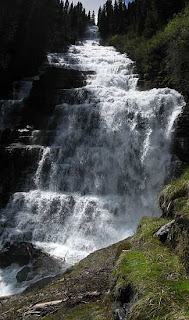
On June 25 Patti and I hiked to a number of waterfalls in the St Mary area of Glacier Park.  2011 was a high snow and high water year so the streams and waterfalls were running high.  After we visited St Mary Falls we continued up the trail to Virginia Falls.


The trail is around 1.5 miles long from the Sun Road to Virginia Falls and it climbs 285 feet to the falls.  For the most part we followed Virginia Creek on our hike to the falls.

The water was coming down much more than any other time I have visited these falls. Usually I could stand where I took the last two photos and not get wet.  Not this time!  I got pretty wet in the very short time it took me to take the photos.


Here is a video of Virginia Falls. It is 2:39 long.   Several years ago a woman fell into the stream from the bridge seen in the video.  She was washed away and drowned.

http://youtu.be/8Ih-XeYPE0I