Showing posts with label North Fork. Show all posts

Sunday, September 27, 2015

Thoma Lookout

On a beautiful Sunday, September 27, Patti and I hiked to Thoma Lookout and later attempted to hike to Mt Hefty.  I had hiked to both before back on September 24, 2009.  Patti had never been to either.

It was time for a hike.  I hadn't hiked since early August before all the smoke from the forest fires.   The weather on Sunday was beautiful.  Sunny and warm after a cool start in the morning.


While Google maps shows the driving time as 2:23 in length, the time from my place (closer to Kalispell) was 2:15 driving up and 2 hours driving back - and Patti drives reasonably, and not like a speed demon.

Other than a few miles in the beginning, much of the North Fork Road had a chemical dust control treatment which has preserved the road quite well and made driving the road smoother and easier.  The treatment ended a mile or so north of Polebridge so the last miles on the North Fork Road was rougher, but manageable.

Six miles from the US/Canada border we turned onto the Trail Creek Road (NF road 114).  After almost 5 miles we turned off onto NF road 114A.  This one lane old logging road ends after 3 miles where the road was blocked off and closed decades ago.  An old map shows the road used to go up to brush along the US/Canada border.  Apparently Google maps knows of the closed 114A road as their alternate route in grey via Fortine is via the closed section of 114A.  One can drive the Trail Creek road across to Eureka/Fortine but the Trail Creek Road does not brush the US/Canada border.

Both the Trail Creek Road and NF 114A are in good condition - better than the un-treated North Fork Road.


The end of NF road 114A has just enough room to turn a vehicle around.  There is room for parking for only a few vehicles at the end of the road.  I have never seen another vehicle on NF road 114A.


The trail Patti and I hiked was trail 18: Thoma - Colts Creek Trail.  It is shorter and has much less elevation change than the Thoma-Hefty trail (15) that starts from the Trail Creek Road (114).


The elevation gain on trail 18 is still a good amount at 1700 - 1800 ft.


If you decide to also hike to Mt Hefty after hiking to the Thoma Lookout add in an estimated another 1000 ft of elevation gain and 5 miles round trip. Estimated as the forest service appears to be letting the Mt Hefty portion of the trail go and I do not have a GPS unit.


Getting out of the car the first thing one is aware of is the quiet.  Dead silence.  No vehicles.  No planes.  No far off people noises.  No animal noises.  Both times I have done this hike it has been very quiet.  This is one of the quietest hikes I have been on.  In the afternoon when the wind blew I could somewhat hear it.  Other than on the mountain tops in clearings, the trees screen out the wind.

The first half mile of the hike is on the closed off part of NF road 114A.  While the road is closed the forest service apparently does cut the alder trees growing onto the road.

The trail off the road is not marked with a sign.  A cairn of rocks marks the side trail.


Then you follow along Colts Creek.  The creek is small, but even in this dry year there was water in the creek.  The creek is also mossy and pretty.

The trail is good.  It is maintained, and other than a short section on Thoma, the trail is not brushy.


Thoma Lookout with the Whitefish Range in the background.

I first hiked to the lookout in 2009 the year they started refurbishing the lookout.  The outhouse was brand new.  Six years later it still looks brand new.  The view of the Glacier Park mountains from the outhouse are magnificent.


Patti and I spent some time at the lookout eating our lunch and admiring the views. The weather was almost perfect: sunny, cloud-free, warm and only a slight breeze.

The lookout was not shuttered yet for the year.  A sleeping bag was lying on a board in the lookout and stuff was out.  Lief, who has staffed the lookout since it was refurbished and re-opening in 2010, was not around.


In this article there is info on Thoma Lookout and Lief who staffs it each year: http://missoulian.com/news/state-and-regional/documentary-examines-life-of-fire-lookout-in-remote-part-of/article_0e0d0658-7d44-11e1-ad86-0019bb2963f4.html


Here is a 16 minute 34 second documentary on Thoma lookout and Lief: https://www.youtube.com/watch?v=6YPBO_ISKuc


After we visited the lookout and soaked in the views, we decided to try to hike to Mt Hefty.  That meant hiking a mile back to the saddle and then taking the trail that branched off to the north.  When we hiked up to the saddle we missed the branching trail and the trail sign.  Our heads were down as we climbed.  I had hiked to Mt Hefty in 2009 so I knew roughly where the side branch should be.

To the left (behind the pine tree in the foreground) is the Mt Hefty trail.  To the right is the trail to Thoma lookout.


The trail to Mt Hefty starts out good.  But as one climbs into grassy areas and places with more open than trees the trails fades unless you know where to look.  The route also goes over three mountains.  Just when you think you climbed Mt Hefty you look beyond to another slightly higher mountain.  Mt Hefty is right on the US/Canada border and the border "line" runs on its northern shoulder with one of the border monuments right on the trail.

Patti had been working 60 plus hour weeks the past month, was recovering from a cold, and hadn't hiked since early August, so she wasn't at full hiking strength.  She made it to the second mountain before she ran out of gas.  From the second mountain one has to go down to a saddle before climbing Mt Hefty.  Patti saw Mt Hefty and got an idea of the views so she definitely wants to come back and hike to Mt Hefty next year.

All along the trail to the saddle, then on the Mt Hefty trail we saw lots of horse hoof prints.  The border patrol monitors this area, especially as it is a easy hike to Mt Hefty and across the border.

By the time we got back to the car we had spent 7 hours hiking (and looking at the views) over about 10 miles.  The hike is not hard, just awesome.  Most people hike to the lookouts in Glacier Park, but the hike to Thoma Lookout and Mt Hefty is a secret undiscovered treasure of a hike in the Flathead, and one of the best lookout hikes around.

Here are 38 more photos from my hike:  https://picasaweb.google.com/109566462412251958234/ThomaLookout?authuser=0&authkey=Gv1sRgCLbCxfqWoKuyjQE&feat=directlink

Saturday, May 30, 2015

Upper Quartz Lake

Saturday May 30, Patti and Linda and I hiked to Upper Quartz Lake in the NW part of Glacier National Park.  It seemed like I had been to this lake more than four times, but based on my photos this was the fourth time.


The hike was 13 miles round trip. The trail goes over the Cerulean Ridge so our hike gained 1800 ft before descending 1600 ft.  Of course, when we returned to the trail head we had to go back up and down the Cerulean Ridge.

Due to the low amount of snow this past Winter there was no snow on the top of the Cerulean Ridge.  The few streams we crossed were lower this year also.

At the Bowman Lake campground, where the trail started, were these signs.  Apparently a mountain lion recently chased a deer through the campground in broad daylight and caught and killed the deer.  The Park rangers later removed the rest of the deer so the lion wouldn't return again.


Bowman Lake at the start of our hike in the morning.

Bowman Lake at the end of our hike in the afternoon. The Cerulean Ridge is on the right side of the photo.


Hiking up to the Cerulean Ridge.

Indian Paintbrush wild flowers.

Early beargrass

One stream crossing

Coming down the top of the ridge I noticed the trees have really grown since I was last here in June 2011.  There used to be many more views of the Upper and Lower lakes.

Upper Quartz Lake as seen from just below the top of the Cerulean Ridge.

Lower Quartz Lake as seen from just below the top of the Cerulean Ridge.

Quartz Lake with Vulture Peak in the background left of center.

At Quartz Lake a butterfly took a liking to me.   It would sit on my shirt... my arm.. my hand... even my hat.  When we left the lake the butterfly stayed on my hat for at least a half mile or more of hiking from the lake before flying off.


Friday, October 10, 2014

Coal Ridge lookout

On Friday October 10, after Kendra completed another radiation treatment,  Joyce, Kendra and I hiked to the cabin and lookout tower on Coal Ridge in the North Fork near Polebridge, Montana.  With the around eight miles that I did on this hike, I have now hiked over 100 miles for the year so far.

I had first learned of this lookout from a story in the Hungry Horse newspaper about a recent restoration project.

http://www.flatheadnewsgroup.com/hungryhorsenews/fire-lookout-gets-a-new-lease-on-life/article_617000ca-497f-11e4-aa5b-c32ea6ab4c38.html

Here is a link to the group that did the restoration.  Look for the Moran Patrol Cabin section.

http://www.nwmt-ffla.org/#!2014-projects/c1nlq

Coal Ridge actually consists of three lookout points along the ridge-top. The first was a cabin at the west point (7285') in 1928. A 24' pole platform tower was added in the 1930's 1.5 miles southeast of the cabin at the 7100' level. Then in 1935 a 20' pole L-4 tower was constructed 1 mile southeast of the original cabin at the 7105' level. Used for emergencies in the 1960's, it has obviously not been maintained for a number of years.
Here are a couple of historic photos of the platform and tower lookouts.


There are several ways to reach the lookout and cabin, but the easiest way is to use the Moran Creek Trail, trail number 2. From the North Fork Road go on Forest Service Road 376 (Hay Creek).  Then go on the Moran Creek Basin road: Forest Service Road 5241 until it ends at a berm in the road.

The trail head is six to seven miles from the North Fork Road which was over 30 miles from Columbia Falls.

Trail 239 is a shorter trail at 1.9 miles long, but a much steeper trail with about 3100 ft of elevation gain.


The trail head is only marked with a small rock cairn on the side of the road a short distance from the road's end.  The trail is not the closed road beyond the berm.  There is no trail head sign or post.

Moran Creek Trail number 2 is 3.04 miles to the junction with trail 14.  The junction is between the cabin and the lookout tower.  The cabin is a little farther away and higher than the lookout tower.  The cabin might be a half mile or more from the trail junction.

I don't know the elevation gain on trail 2.  The trail starts out with a quick elevation gain from the road to get the heart racing, but then settles into a steady but not steep climb. The trail goes along the mountain side until it gets closer to the head of the valley.  It passes by a few small streams that were easy to cross at this time of year.  We also crossed a few muddy seeps that had us go off trail around them.  There was only one recent downed tree across the trail.  From signs of other downed trees the trail appears to be maintained.

Trail 2 ends at trail 14 which runs along the top of Coal Ridge.  The trail junction is at a saddle on the ridge, the lowest part of the ridge.  The steepest part of the hike is on the ridge to the cabin and to the lookout tower.  Kendra ran out of gas on the hike along the ridge to the cabin and did not make it there.  Joyce joined me at the cabin.  Joyce and Kendra then started to hike back to my pickup while I hiked up to the lookout tower.

The lookout tower is not as it appears in the historic photo.  The roof had blown off and landed upside down against a grove of trees.  The roof was mostly intact. The tower's floor walls were gone into a pile of wood at the base of the tower's legs.   The tower's legs were still standing but who knows for how long.  One of the legs no longer was on its concrete pad and several cross trunks were gone or broken.


The tower's structure is different from most lookout towers in that the legs (support structure) were made of tall thick tree trunks bolted together.

When we had gotten to the junction of trails 2 and 14 we could not see the tower or cabin and had to trust which way to go.

The cabin can be seen from the road's end and from a point close to the trail's beginning (as shown in the photo below).  Otherwise you do not see the cabin again until either when you begin the hike to the lookout tower and look back, or at the end when you approach the cabin.


As we got closer to the ridge we could smell smoke.  On the ridge we could see smoke from beyond the next ridge from what appeared to be a controlled burn.  Without the smokey skies we would have had awesome views of the Glacier Park mountains.  This day they were partially obscured.

At the trail junction you can finally see over the ridge down into the Coal Creek valley.  It is a long way down and I don't doubt it would be a 3100 ft climb from the floor to the cabin.

Coal Creek Valley with smoke from the fire.


From the cabin I had great views of the Whitefish Range Mountains and could pick out the ones (Tuchuck, Thoma, etc.) I had hiked on. The skies were not as smokey in that direction as the breeze had not blown the smoke that way.

The cabin was not locked. It was clean and stocked.


From the ridge there were lots of views of the Moran Creek Basin.  I could easily see where the forest had been logged some years ago.  Above that line the trees were all green with a troubling amount of old dead trees.  Below the line the forest was a healthy green with lots of yellow from Western Larch.  The trails were above the logged line so one did pass by a number of snags standing over the trail.


There is no trail to Moran Peak but it doesn't look like it would be difficult to hike to the top of that peak for more views.  I also did not have time to hike east past the tower lookout to search for the platform lookout.  I imagine that would be ruins also.  I also didn't see an obvious trail (trail 14) east of the tower lookout though it also did not appear to be difficult to walk east along the ridge.

If you are interested in what happened after the hike was over, follow this link.

http://tallpinesranch.blogspot.com/2014/10/pickup-breakdown.html


For more photos, follow this link:

https://plus.google.com/photos/109566462412251958234/albums/6069156543016988481?authkey=CL649cXz1Y_n3AE

-

Friday, October 12, 2012

Bowman Lake

Friday, October 12, after we hiked to Logging Lake in Glacier Park, Patti, Patti's co-worker Jerry, Joyce, Bill's niece Cheryl, and I drove over for a quick visit to Bowman Lake as Cheryl had never seen the lake.  Bowman Lake is one of my favorite lakes in the Park.


Rainbow Peak and Square Mountain.  Square Mountain is the smaller pointy mountain in front.


Rainbow Peak


Zooming in to the far end of Bowman Lake.  The "Hole in the Wall" area is just left of center.


Logging Lake

Friday, October 12, Patti, Patti's co-worker Jerry, Joyce, Bill's niece Cheryl, and I hiked to the first campground on Logging Lake in Glacier Park.  I had never been here before.


It was 5 miles to the first campground.  As you can see from the sign below, Logging Lake is a long lake.  Someday I will go further.  Maybe all the way to Grace Lake.


The elevation change is not much.


It was a cool morning with the temperature in the lows 30s when we started.  But the sun burned out the fog and it soon warmed up and people began to shed their jackets.

We soon walked through the remnants of an old fire.  I believe this was the Wolf Gun fire from 2003.


I never noticed it until now but Logging Lake is almost the same latitude as the most northern part of the Going-to-the-Sun (the Loop area).  The long drive up the North Fork road to get to Logging Lake, and the remote area, makes one think they are further north than they actually are.


On the hike back to the car we heard a few howls by a wolf some distance away.  Here we are listening for the howls and looking for signs of a wolf.


The Park employees had chainsawed quite a number of downed trees along the trail.


Three tenths of a mile from the campground is a ranger patrol cabin. We ate our lunch on the picnic table in front of the patrol cabin.


Here is the patrol cabin's outhouse.   Fancy... but they forgot the door.  Another suggestion...if they leave the door off, turn the outhouse around so the people could have a view of the lake while tending to their business.


Near the outhouse were two pile of branches stacked as shown. It looks to be a slash pile for burning.  But they wouldn't do that in the Park would they?  And certainly not so close to other trees.


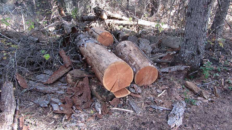
Logs from a tree cut down next to the patrol cabin.


The view up the lake from the patrol cabin.


The campground only has three sites.


View of the lake from the campground.


At the campground we got a fire going.  Last time Patti was here she didn't notice many sticks and branches for burning so she asked me to pack some firewood along.  We were able to easily find more dead wood for the fire.


We roasted marshmellows and made S'mores from the ingredients that Patti brought along.


Patti and Jerry each brought a bottle of wine to have with our S'mores.  Here is one of the S'mores I made.  Some people ate plenty of S'mores and got a sugar buzz.  The wine had nothing to do with it. 


Video of the group making and and eating S'mores at the campfire.  21 seconds long.

http://www.youtube.com/watch?v=qZfBQcxvEZM


Near the campfire area was a metal can for watering.  The sign said it was for watering the small pines trees planted near the can.  We found the can to be handy to completely put out the fire before we left and returned to the car.


Here is how we fill the can with water.


Here is the bridge one crosses to pass from Polebridge into Glacier Park.