Showing posts with label Peaks. Show all posts

Friday, September 7, 2018

Baldy Mountain in 2018

On September 7 I once again hiked to the top of Baldy Mountain.   Bill's niece, Cheryl, and her friend Leah, are visiting from Wisconsin and wanted to go on a hike with Joyce when they were here.  Joyce asked me for ideas.  In hindsight it would have been better if Patti still lived in Montana as my first inclination is to hike to a mountain peak and Patti's first inclination is to hike to a lake. How in the world did we make such a good hiking team?   (By the way Patti, Cheryl says "hi" when we reminisced about our hike to Cedar Lake. <http://tallpineshiker.blogspot.com/2009/09/cedar-lake.html>)

Where to go?  With all the fires it is smoky.  Parts of Glacier Park are closed due to the forest fires there, and the Park is still busy with people.  I figured Baldy Mountain is south and west of all the forest fires and wouldn't be as smoky.  And in the morning that looked to be true.  But there are forest fires in Idaho and with the heat in the afternoon it got smokier and smokier.  So views were not as good as they should be.

The driving route from Kalispell

Directions: In Plains turn onto Clayton Street and stay on that paved road nearly to its end. At a fork in the road, leave the paved road and turn left on a Forest Service gravel road with no marker other than a small sign with the number 2 on it. Follow this road for several miles, turning right at a narrower road with the little brown sign with a white hiker symbol on it. Stay on this road until you see the trail head sign, where you'll park.
The driving route from Plains, MT to the trail head


Once we were driving on the narrow road we saw a yearling black bear run from the left onto the road a short distance before crossing off to the left.  All of us were surprised and no one had a camera ready, so no photo of the cute little bear.  We were all glad to be in the car.


More of a 3D view to try to give you a sense of the elevation change.

According to the signs the distance is 2.6 miles one way, for a total of 5.2 miles.  My Garmin Etrex 30 GPS has the distance as 5.7 miles.  But something is suspect.  The two halves should be a mirror image and they are not.  Leah developed knee pains and at around the 2 mile mark stopped climbing.  Joyce and Cheryl continued to the top while I stayed with Leah as I have seen the view from the top before. I sat on a log and ate a lunch as I kept Leah company.  The chart seems to have continued to (erroneously) record movement during this time of sitting for about a third of a mile based on the flat part of the chart.


"Offically" I had read that the starting elevation is 5900 feet and the top is 7400 feet for an elevation gain of 1500 feet.   My GPS had us starting and ending at around 5400 feet and the top was a little over 7400 feet for an elevation gain of a little over 2000 feet.  In this I am a little more trusting of the GPS.

Three years ago I had hiked this trail with Patti.  (http://tallpineshiker.blogspot.com/2015/08/baldy-mountain.html)   We had hiked (climbed two mountains that day); both in almost equal distance and elevation gain.  We both felt the Baldy Mountain climb was harder.  We put that down to Baldy Mountain being the second climb of the day.  Now I suspect Baldy Mountain does have a higher elevation gain.


As Joyce and Cheryl were returning I continued the climb to the top while the three hiked down the mountain back to the car.  After seeing the view from the top I caught up to them before they reached the car.  On the hike down the mountain Leah's knee felt better, but her ankle was now bothering her.

Also on the hike back to the car I learned Joyce and Cheryl hadn't walked to the south end of Baldy Mountain.  From there you can look down on Baldy Lake.

Everyone said they enjoyed this adventure of a hike even if it was a bit disappointing to have smoky views; and Leah was disappointed not to make it all the way to the top.


Here are photos from the trip.  Use the link to the hike with Patti to see how the views are smoke-free.


Trailhead


Thompson Peak to the north in the background.


This is new since the hike I did with Patti.  The last half mile of the hike is over rocks.  Someone found a rock that looks just like an axe and placed it in rocks at the corner of a switchback.


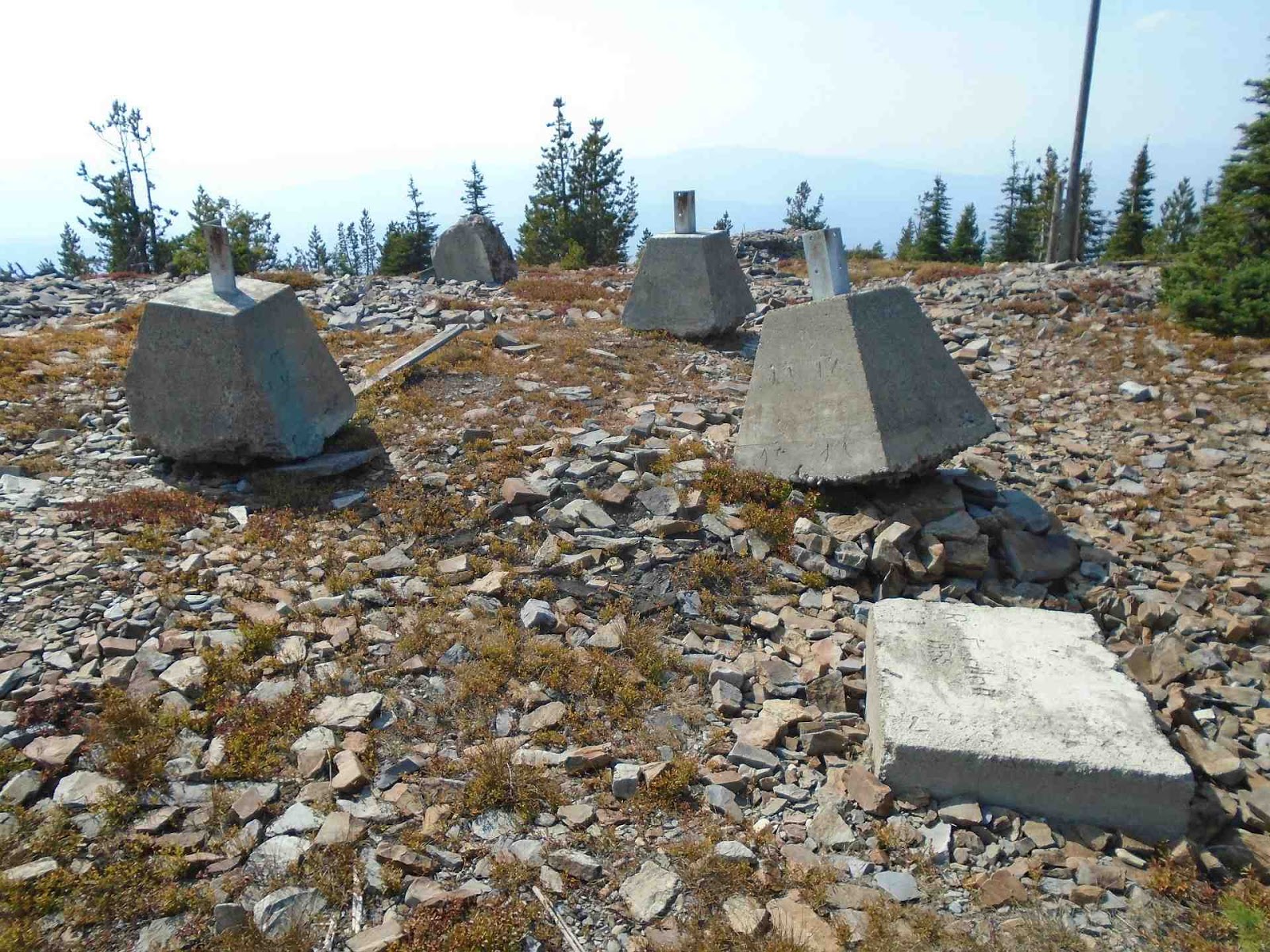
Old remnants of a lookout?

It appears there may have been a newer lookout at some time in the past.

This is also new since Patti and my hike.  Someone had time to play with rocks.   The rocks were placed on what looks like to be concrete that was spread out rather than hauled back down the mountain.  Why the concrete... I have no idea.  The concrete was nearer (west) of the original rock lookout foundation.


I believe this smoke is from the Garden Creek fire.  The fire was started by lightning on July 29 and was 100% contained by August 22.


Baldy Lake

Saturday, July 23, 2016

Mt Headley hike

Saturday, July 23, 2016, Patti, Joyce and I hiked to the top of Mt Headley in the Cabinet Mountains.  This was the last of the hikes with Patti before she moved to Wisconsin.  Over the past few weeks we had done a hike in most of her favorite areas around here:
  1. Glacier Park (Red Eagle Lake)
  2. Southern Swan Mountains - with a good view of the Mission Mountains (Upper Holland and Sapphire Lakes)
  3. Northern Cabinet Mountains (Cedar Lakes)
  4. and now the southern Cabinet Mountains with this hike to Mt Headley.

I don't remember it taking us almost three hours to get to the trailhead.  Between the company present and the drive along the Clark Fork valley from Plains to the trailhead must have warped time.


The hike was 8 miles long round trip.   We started our hike at the trailhead at Vermilion Pass where there was plenty of area to park your vehicle.  At Vermilion Pass the elevation was 6026 ft.   Mt Headley is at 7429 ft. The elevation change was 1403 ft.  Mt Headley ranks as the 1266th highest mountain in Montana.


Prominence is defined as the elevation of a summit relative to the landscape surrounding it.  Apparently Mt Headley is ranked #27 in prominence in Montana with 3716 ft of prominence.  I didn't remember Mt Headley being so prominent - maybe because we started the hike so high and only had 1403 ft of elevation gain.  Then I remembered looking down on a small plane flying below when standing on Mt Headley.  I have a 10 second video of that.  https://youtu.be/q2kwOiRS_Vg


I got this photo from the Internet.


As we drove to Vermilion Pass we passed by this waterfall.  I am not sure the creek's name.  Maybe Graves Creek?


Here is a 27 second video of the falls: https://youtu.be/tzO0NrZFiuM


The view off to the northern side at the start from Vermilion Pass.


The trail forked here.  With no signs we weren't sure which way to go.  This is the view of the left fork.  This was not the trail to the top of Mt Headley.   If you look back to the photo with the labels "start" and "Mt Headley", I believe the following photo view is the same as the snow covered mountains on the left side of the earlier photo.


Mt Headley is the high point on the right side of the following photo.


Patti and I had hiked to Cabin Lake in July 2015:  http://tallpineshiker.blogspot.com/2015/07/cube-iron-mountain-and-four-lakes.html


Views from the top of Mt Headley.


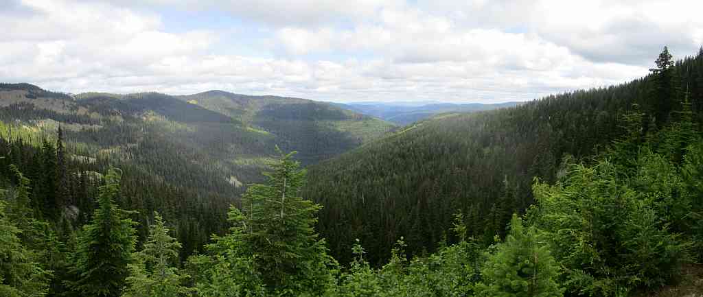
Looking NW towards the Cabinet Mountains Wilderness area.  Earlier in the week Patti and I were at Cedar Lakes in this area and I don't remember the mountains being so tall.


Apparently this is a lookout on top of Priscilla Peak.

Too bad Patti moved away.  If she was still here the Priscella Peak lookout would have been a future hike for us.  That is how we explored the Whitefish Range: hike to the top of a mountain, look over at another mountain, see something and plan a future hike to that mountain.


Parts of the trail were brushy.  The brush was still wet from the previous night's rain.  Patti is wringing out her soaked socks once we were at the top of Mt Headley.  Patti had a second dry pair of socks and on the hike back down the mountain the brush was dry.


Joyce.  A pretty good hiker for someone around 80 years old and who had knee replacement surgury back in January.


Here is a 57 second video of the views from the top of Mt Headley: https://youtu.be/yqmdTJMRu_M

For more (better) photos of Mt Headley:  https://montucky.wordpress.com/tag/mt-headley/

Tuesday, July 19, 2016

Lower and Upper Cedar Lakes

On Tuesday July 19 Patti and I hiked to Lower and Upper Cedar Lakes and most way up Dome Mountain.  Even though Patti, Lynda and I had hiked the Upper Holland / Sapphire Lakes loop two days earlier on Sunday (and Patti and I were still recovering), Patti had a free day waiting for the movers to come pack up her stuff for her move to Wisconsin and she wanted to go on a hike.  So did I.  I reminded Patti of her interest in going on the Cedar Lakes hike with me as she was very impressed with the lakes when she did the hike a few years earlier with Mary.

So at 7 pm on Monday we decided to hike to Cedar Lakes.  A last minute thing and too late to get more people to join us, especially on a weekday.

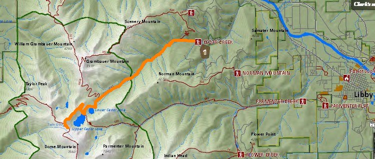
Cedars Lakes is in the Kootenai National Forest in the Cabinet Mountains west of Libby, Montana.


The distance we hiked was 15 miles.

We started at an elevation of 2997 ft and the highest elevation we hiked was 6941 ft.  The elevation gain/loss overall on the hike was 4157 ft. 


We hiked for 7 hours and 4 minutes and stopped and enjoyed the scenery for 2 hours and 15 minutes.  Our total time from start to finish was 9 hours and 19 minutes.  A good day of hiking.

Overall the weather was good.  We were happy to have the shade of the trees on the climb up to protect us from the hot sun.  Clouds came as we hiked back to Patti's car and a brief rain shower with large raindrops got us wet.  The thick tree canopy didn't keep us dry.

Between the distance and  the elevation we both were tired at the end of the hike and happy to be back to the car. 


The Forest Service Road to the trailhead is in excellent condition. There was ample parking at the trailhead.

The trail mostly follows along Cedar Creek.   The thick cedars and water reminded me of western Washington.


The hike was a steady climb to both Lower and Upper Cedar Lakes.  The trail was very clean all the way up and at no point did we lose the trail (though the junction with Upper Cedar Lake isn't marked, its fairly obvious).  

There were a good number of groups of downfallen trees.  Most all were cut allowing for easy passage.  The exception was the spur trail to Lower Cedar Lake.  None of the downfall was cleared and we had to search to  find a way around the trees to reach the lake.

Huckleberries were all along the trail, with the majority being after you pass the Wilderness boundary. 

The trail to the lower lake was mostly in the trees with good shade.  To the right of the trail is the young regrowth after a previous forest fire which allows for some open views of Scenery Mountain and later Grambauer Mountain that rises up from the trail.


When hiking between Lower and Upper Cedar Lakes we met a father, son and their dog who had been staying at Upper Cedar Lakes.  The dog growled at us when they approached us but the dog didn't do anything.


The dog had his own pack.


At the Upper Cedar Lake we talked a while with a grandfather hiking with his grand-kids. He grew up around Libby but now lives in eastern Washington.  He seemed to be enjoying the hike more than the grand-kids.

Granddad, grand kids, and Giant Patti.


Above Upper Cedar Lake we hiked up and around the backside of the shoulder of Dome Mountain.  On the backside was a short bridge over a steep deep drop.


The view from near the bridge of an unnamed lake in another valley.


For 24 more photos from our hike: https://goo.gl/photos/akPcdyfrvc2RFSdj9


Video of Cedar Creek  (1:35 long): https://youtu.be/9wWZWTRaYNI

Video of Lower Cedar Lake (22 seconds): https://youtu.be/cM9TcLXyrNQ

Video of Upper Cedar Lake (30 seconds): https://youtu.be/tvTZWQV24f8

Video on Dome Mountain of both lakes (36 seconds):  https://youtu.be/MklwwS8N_CU