Monday, September 4, 2006

Piegan Pass to Many Glacier

Last Friday our group hiked over Piegan Pass, down into the Many Glacier Valley and over to the Many Glacier Hotel at the northeast end of Swiftcurrent Lake.

There were 6 hikers and three drivers. We needed two drivers for two vehicles, as the beginning and end of our route were many miles across a mountain divide. The drivers were Bill's and Arnie's wives.

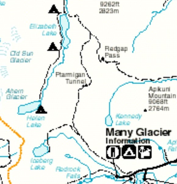
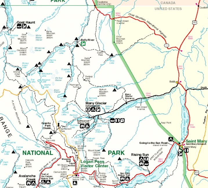
The map shows the driving route from Siyeh Bend to Many Glacier.

The six hikers were:
  • Bill
  • Joyce
  • Edley
  • Arnie
  • Edwina 
  • me
Sue Ann is kayacking in Jackson Hole, Wyoming. Earlier she had called Bill to let him know that at that moment she was on the lake as she knew Jackson Hole is one of Bill's favorite areas.

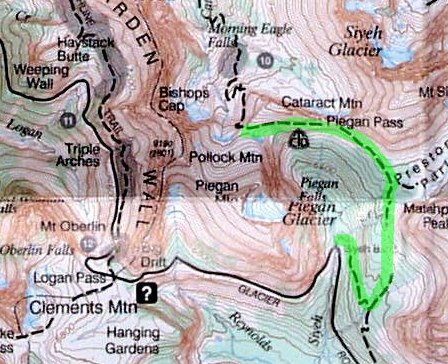
Here is a link to an interactive map showing our route. Move your cursor over the red 26 and 36 on the map to see photos of Piegan Pass and the Swiftcurrent Lake and Many Glacier hotel area.

A couple more maps:

Joyce and Edley picked me up for the 8 am meeting in Columbia Falls. Edwina had been there since 7 am as she had the meeting time wrong.

It was a cold morning and I had frost on the lawn and hayfield. I left my garden covered.

At we drove up Going-to-the-Sun road to cross Logan Pass there were clouds. A few miles before the pass we drove through the clouds and could look down on their sunlit tops as they filled the valley. The east side of the pass was clear.

We started our hike at the Siyeh (Sigh' - ee) bend.
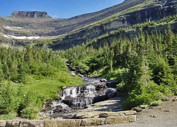

The low shrubs and flowers along the stream were white with frost until the trail turned into the tall pine trees. Everyone but Edley wore a coat. He said the cold didn't bother him. On top of that he was only wearing a short sleeve shirt. Brrrr!!

I wore my splint on my sore wrist and had my hand in my coat pocket as I hiked. It helped.

Only Arnie and Edwina brought bear spray and they hiked in the back. I was in the front and said maybe they should lead. "No thanks", they said, "bears prefer young people as they are more tender and juicy to eat than the old tough people." Thanks...

Bill and Arnie got adventurous and bushwhacked a shortcut. You wouldn't think Bill was in his 70s and Arnie is 81. They later speculated about hiking/bushwhacking from Siyeh bend straight up to the pass on a future hike. The rest of us stayed on the trail.

The trail split and another part went to Siyeh Pass. A sign warned of recent bear sightings on the Siyeh Pass trail. Glad were not going there.

We met a young back country ranger coming down from the pass. We chatted with him about the trail, bear sitings, his job, and where he was from.

Closer to the pass we spotted two bighorn sheep. The first one was a good distance below and we initially debated if it was a rock - until it moved. The second sheep was sitting and chewing and had massive and impressive curled horns. I imagine these bighorn sheep were the cause of the animal tracks on the steep snowfields against Pollock Mountain.

Here is a view back to Siyeh Bend.


On the right of the stream is where Bill and Arnie would like to bushwhack and look for what they believe is an old abandoned trail to the pass from the bend.

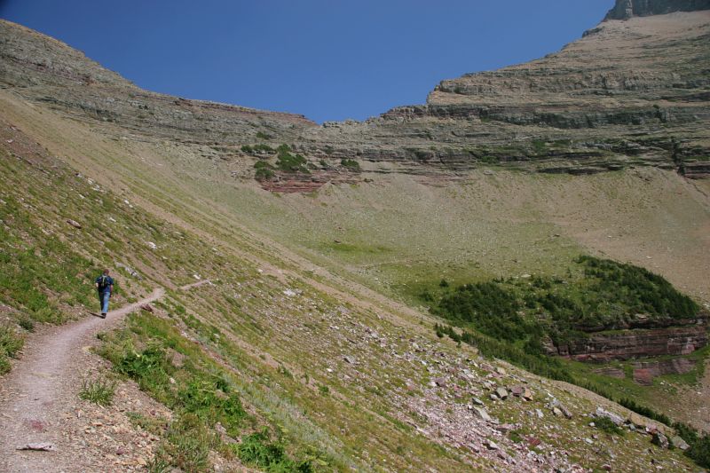
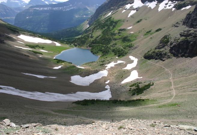
Here is a view of Piegan Pass. To reach Piegan Pass we climbed 1750 ft in 4.5 miles.


This 360 degree view shows the entire route from Siyeh Bend to the pass:


The mountains still had fresh snow from the previous couple days. I went over to some of the snow against the Pollock Mountain. Yup, fresh wet snow. The mountains and views were extremely gorgeous. I really wished I had a camera!

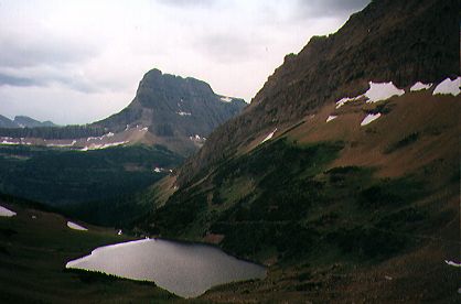
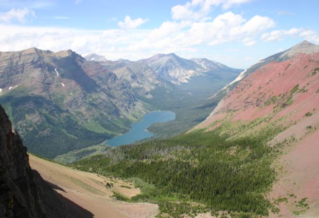
We ate our lunch at the pass with magnificent views of the backside of the Garden Wall, Piegan Mountain, Mt Gould, and Siyeh Mountain. The following photo is the view from the pass down into Many Glacier valley.
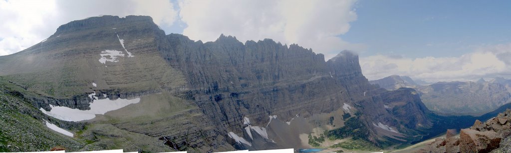

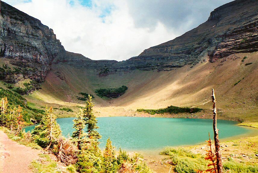
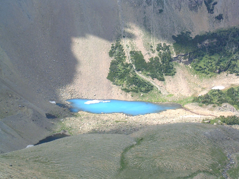
To the west, at the base of the Garden Wall, from this distance the scree / gravel that lay below the vertical drop looked like fine sand. A small turquoise lake was at base of the scree / gravel.
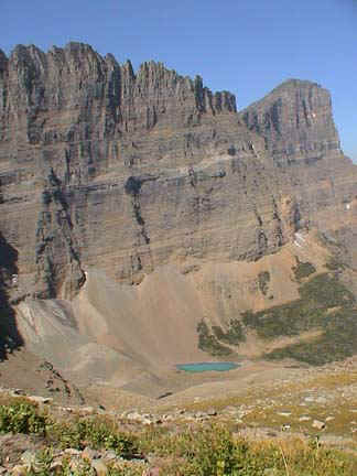

At times a cool breeze blew as we sat on rocks and ate our lunch. Brrrr. But the views were worth the chill.

The route to the Many Glacier Hotel descended 2640 ft over 8.3 miles. When going down into the Many Glacier Valley, for about a half mile to a mile, snow was on the trail. The trail was on the north side of the pass. Light snow, but wet and slippery. I seen that some permanent snowfields had large cracks where the field slipped slightly.

Arnie has climbed a number of mountains: Siyeh, Gould, Angel Wing. No technical climbing. He climbed Siyeh twice. His last climb of Siyeh was 15 years ago when he was 65.

We came across a few instances of purple bear scat on the trail. Fortunately, not fresh. The color was from the huckleberries. There were still huckleberries and thimbleberries to be picked.

We would pause ever so often to pick some berries the bears had left. The thimbleberries were past season as they were either very ripe and would fall apart when picked, else dry. We also saw many signs were the bears had torn the dirt and rocks along the trail in search of something.

We hiked past Morning Eagle Falls. Along the way we had seen the stream that fed the falls; then the trail went down for views from across then below the falls. Very nice.

After 6 miles we reached Lake Josephine. One could take a boat across this short lake to a narrow piece of land, then another boat across Swiftcurrent Lake to the Many Glacier hotel. Edwina, Bill, and Joyce waited for the boat. Arnie, Edley, and I hiked the 2.2 miles along the lakes to the Many Glacier hotel.

The photo is of Lake Josephine looking up the valley that has the Grinnell glacier. The glacier in the photo is not the Grinnell glacier.

There were more people now on the trail. We had seen a few people on the trail from Siyeh Bend to Piegan Pass who were only hiking to the pass. We had seen no one on between the pass and the lake.

We got to the lodge 13 miles and 6 hours later. We were tired. Arnie said his body sure knew it had been somewhere that day.


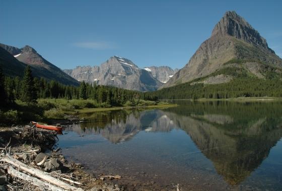
In the photo of Swiftcurrent Lake, to the right behind the mountain is the valley with the Grinnell glacier. To the left behind the mountain is where we had hiked from the pass.


The ladies were waiting at the hotel. They said they had a good time and the time passed quickly. I checked out the hotel before sitting down on one of the couches around the large fireplace - which was burning logs.

We all went outside to meet the boat. The boat was full but did not have our hikers. A person getting off the boat said people were left for the next boat as this one was full. While waiting for the next boat Edley, Bill's wife, and I sat down outside on a picnic table to wait. We ended up chatting with a couple from near NYC who had rafted the Snake river in Idaho before visiting Glacier.

An hour later the next boat brought our hikers. It turns out ticket holders (round trip) had priority. That is why our hikers weren't on the prior boat. When we had left them at Lake Josephine only a half dozen people were waiting for the boat. Then people started to continually arrive, followed by a large park ranger led group. The boat holds 49 people and the boat they arrived on had 48 passengers. They barely fit on the boat.

Here is a view of the hotel.

As we drove out of park we saw cars and people on the side of the road looking down towards a lake. A man was walking to the lake. We stopped and asked people watching what they were looking at. A grizzly bear was along the lake, although now was hidden from view by trees. It was after 6 pm and I joked it was dinner time for the bear. The man started to walk back up to the road as we left. No bear snack tonight.

The Park Cafe in St. Mary was full when we arrived. The outdoor seating was closed. It was a long wait so we went to another cafe. No pie at this place. Hamburgers and salad. Also ice cream.


I didn't get home until almost 9:30 pm . It was dark and I was tired. But the day's hike was well worth it.

Sunday, August 27, 2006

Ptarmigan Tunnel

Last Wednesday our hiking group drove to the east side of Glacier Park to the Many Glacier area where we hiked up to the Ptarmigan Tunnel.  The Many Glacier valley is one of the more beautiful valleys in the Park.


The trail to the Ptarmigan Tunnel is 5.2 miles and climbs 2300 ft. The trail has two major elevation gains, each over a short distance. The first gain is at the start and gains about 700 ft. The second major climb is at the end, from Ptarmigan Lake to the tunnel. Here the trail gains 600 feet in .9 of a mile. The remaining 1000 ft of elevation gain is spread out over the rest of the trail.


Click here to see another map. When you move your cursor over the red dots, photos appear of places along the trail.


This was about the first chance to hike to the Ptarmigan Tunnel this year. Because of snow the trail opens late. Then this year there were two sub-adult male grizzly bears frequenting the trail. The Park had the trail closed for many weeks due to the grizzlies. Finally last Saturday the trail was reopened as the grizzlies had moved off.

It was a very early start for me Wednesday. Joyce and her husband, Edley, came to get me at 6:45 am. I may have had six hours sleep. As mentioned in my post about the two Holsteins I also had cattle issues before I left in the morning.

There were eight of us in the hiking group today. Gary and Suzy weren't here today but Arnie joined us. Arnie is 81 years which surprised me greatly when I learned this late in the hike. I took him to be in his mid 60s. Arnie had no problem hiking this trail with us. Near the end of the hike when he was leading the group some people had trouble keeping up with his pace.

A short distance into the hike we met an interpretive ranger on his day off work. He pointed out an area on the south side of the valley where seven to nine grizzlies come out in the evening to forage. On our way back in the late afternoon we stopped a few times to scan the other side of the valley but didn't see any bears.

The interpretive ranger was a retired military man. He and his wife live in their large motorhome. He works at two to three national parks each year as an interpretive ranger. He hasn't worked at the same park twice. What a nice way to live one's retired life.

While there were open areas, the hike to Ptarmigan Lake was mostly in trees. A few miles before we reached the lake we caught up to a couple from Chicago, and they joined our group so as to hike with a larger number of people in case there were bears. I chatted with them for quite a while as they were interesting. He was born in Denmark and moved to the U.S. back around 1972. "The time of Nixon, McGovern, Kent State, etc." I talked of my visiting Denmark and Sweden.

Somehow we got on the subject of the minimum wage and the initiative on Montana's ballot this Fall to raise the minimum wage. That led to talking about big box stores and Walmart. Even though she described herself as a very liberal person, she did shop at Walmart - unlike many of my other very liberal friends. I had to tease her about shopping at Walmart. She took it well.

At Ptarmigan Lake we stopped for lunch. Sue Ann took her shoes off and waded into the lake. A few other people who arrived later also waded in the lake.

Two young ebullient women arrived and sat to our right. They left the lake before we did and we could see their progress on the trail as it climbed to the tunnel. The small white girl bounded up the trail then waited for the slightly overweight black woman to catch up before bounding up the trail again. Later Sue Ann, the Chicago couple, and I caught up to both of them at the tunnel.

Georgia and Jasmine. They looked to both be around 20. Jasmine was part Jamaican, English, and Cherokee. The blend did her justice as she was pretty.

Georgia is best described as being a "sprite". She was petite and seemed a little over half the size of Jasmine. Okay, that may be an exaggeration but that is the best I can do to describe her size. One could easily draw Georgia as a cartoon character: she seemed to be hiking boots and dreadlocks. Georgia is white as she originally is from New Hampshire and now lives in Florida. She said she accidently ended up in Florida.

"Accidently?", I asked. "How does one accidently end up in another state?" Her parents had divorced and a relative asked if Georgia want to stay with her for a while.

Georgia and Jasmine (from California) are working at a privately owned tourist restaurant and campground in St. Mary. Georgia said that the owners took one look at her dreadlocks and said she would be working in the campground and not the restaurant. I don't know, I thought her dreadlocks were cool. They fit her personality: lots of "wow"s and wide-eyed wonder and laid-back attitude.

If Georgia had been around when I grew up, I would say she would have been a "flower girl". You know, a hippie. But this being 2006 she wasn't wearing a flowing dress like the flower girls wore. Her hiking boots made her feet seem oversized, like a cartoon character. The rest of her outfit, blouse and short shorts, seemed more suited to tripping down a city street instead of a mountain trail.

Georgia and Jasmine planned to hike to the Chief Mountain customs station. They were now 5.2 miles into a 19 mile hike. Yes, the trail does go down from the tunnel but the end of the hike from the Belly River ranger station to the customs station is uphill. Though not up a mountain, 16 to 17 miles into the hike that uphill may feel like up a mountain. Then they would have to hitch a ride back to St. Mary.

After I took some photos of the two girls with Jasmine's camera, they bounded down the trail. Or I should say, Georgia bounded and Jasmine followed.

"Don't worry, we have plenty of food!" As they had small packs, I wondered where?

This is the view of Ptarmigan Lake with the tunnel in the background. Okay, you can't see the tunnel in the photo but trust me, it is there.


The trail as it switchbacks up the mountain to the tunnel. Look along the ridge for the lowest point. It is where the red rock meets the gray rock. Then go down towards the trees above the lower red rock. Just above the trees is a small back spot. That is the tunnel.


The lake and Mt. Grinnell in the background. Mt. Grinnell is on the south side of the Many Glacier valley and along its flank is where the ranger said one can see bears in the evening. The mountain on the right side is Ptarmigan Wall.


From the tunnel the view back towards the lake. Above the trail, above the snow, on this side of the trees, we saw a half dozen big horn sheep grazing. Mothers and babies.


I was the first to reach the tunnel and I called down that it had doors. The Danish man thought I was joking. It makes sense to have doors to keep the snow out. The doors were metal: heavy and thick. They looked old.


Here is the view as one exits the north side of the tunnel. The lake is Elizabeth Lake. This lake is in the Belly River section of Glacier Park: the very NE part of the Park.


While this view is impressive, I recommend hiking a half mile down the trail. To the west (left) are tall, jagged, snow covered mountains rising out of a high valley that has Helen Lake. Try as I may I never was able to see Helen Lake as the mountain's shoulder in my foreground hid the lake in the deep valley below.  But we were able to see the very large Ahern Glacier.

Sue Ann told a story of when she hiked to the tunnel with a previous boyfriend. While he readied to take a photo, he had placed her bag on the stone wall, as can be seen in later photos. A strong gust of wind blew her bag over the side. All her important stuff was inside, such as keys, driver's license, money, etc. The bag came to a rest among the rocks below the yellow circle. You can see a line where the rocks come out a bit and don't go straight down. The boyfriend climbed down to retrieve her bag. When climbing back up and reaching a narrow steep section he lost his nerve and everyone there had to encourage him to continue. He made it. Crazy!

As you can see, without the tunnel, crossing the mountain is impossible unless you are a mountain / rock climber.

No snow when we were there, but it was cold! The rock was cold to the touch.


What an effort it was to carve the trail out of the mountain side! I believe the trail and tunnel were made for hunting access in the old, old days.


As I had hiked further down than the rest of my group, I caught back up to them as they waited on the southern side of the tunnel. This was in the sun and warmer. Here we sat and ate and talked with other people who had recently arrived. The interpretive ranger told stories of people and their bear spray accidents. A fun time.

Even though my arms were tired from the previous days work, and my wrist was swollen, I went on the hike thinking it wouldn't affect my wrist. I was wrong. I discovered the swinging action of my arm aggravated my wrist so it ached more by the time we headed back to the trailhead. I ended up putting my hand in the pocket of my hiking shorts. That helped my wrist but later my upper arm ached from not moving as I walked. Can't win!

I was very glad the group decided to take a break at Ptarmigan Falls. As we approached the falls I seen a young woman in a bikini laying sideways on a rock near the stream. Wow! Initially I thought it was some sort of photo shoot as everyone we seen on the trail were dressed for hiking.

She wore a small bikini and lay sideways reading a book. That bikini was small! I found a spot a short distance away from the group that offered a good view of the woman. Enough looking at trees - I wanted to look at her curves.

After our hike was over we stopped at the Park Cafe in St. Mary to have a slice of pie. A popular place with excellent pies.  We sat outside on the deck and made small talk and savored our pies. A wonderful day. Perfect weather with clear skies and temperatures in the 70s.